Biwaichi: Complete Guide to Cycling Around Lake Biwa (2026 Edition)
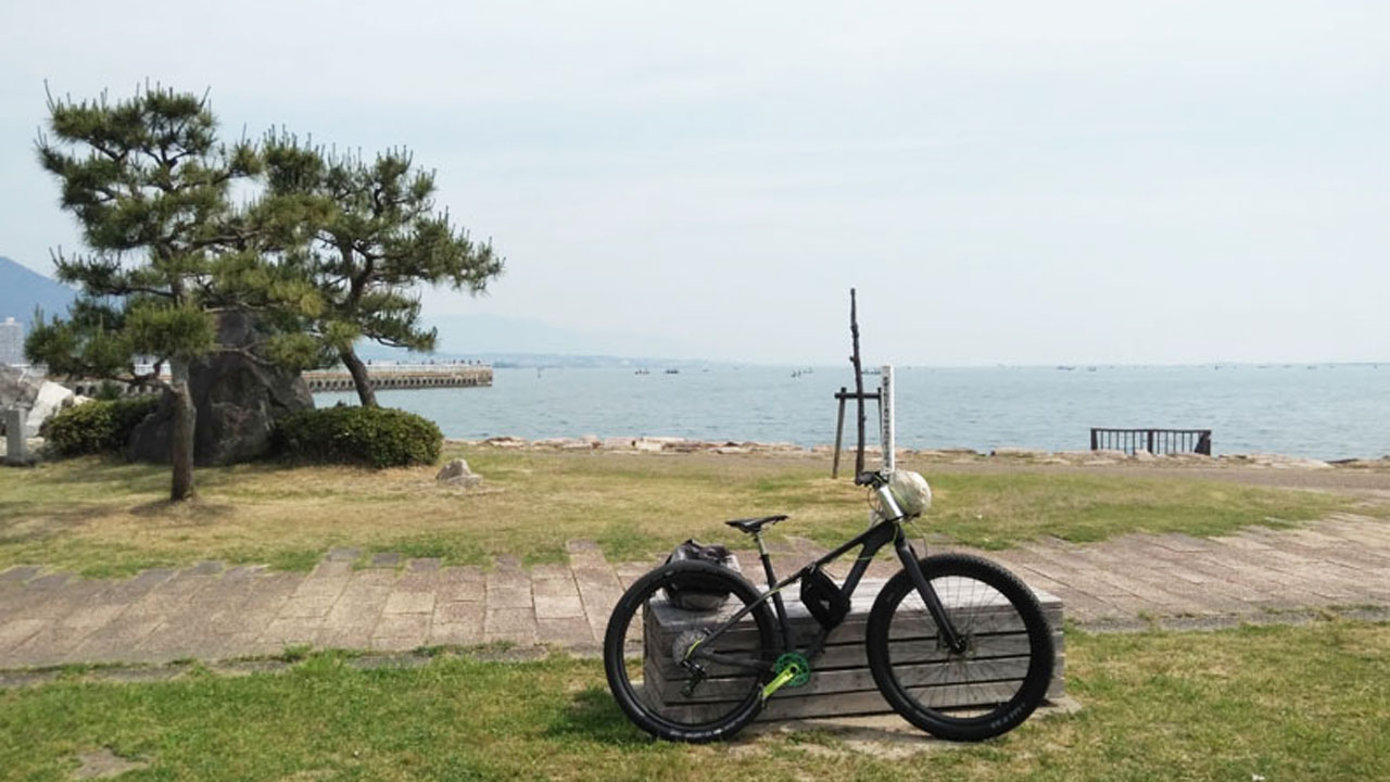
Personal Impressions: My Biwaichi Experience
- Lake East side: Pleasant and scenic ✓
- Lake West side: Intense traffic, be cautious ⚠️
- Recommended overnight area: Kohoku (Lake North)
- Difficulty comparison: Easier than Awaichi
- Beginner recommendation: Two-day, one-night Semi-Biwaichi
This is my personal impression of cycling around Lake Biwa—the famous "Biwaichi."
Biwaichi Basic Information
In the Kansai region's two prefectures and four cities, each has its signature catchphrase. For Shiga Prefecture residents, it's: "We'll dam up Lake Biwa's waters!"
🏞️ Lake Biwa Profile
🚴 Biwaichi Route
- Distance: ~200km (124 miles) full loop
- Elevation gain: ~250m (820 feet)
- Terrain: Nearly flat, minimal climbing
- Promotion: Actively supported by Shiga Prefecture government
The perimeter of this "water reservoir of the Kinki region" is one of Japan's premier cycling, touring, and walking courses. The bicycle loop known as Biwaichi has gained particular fame.
Two Route Options: Full vs. Semi
Lake Biwa is primarily divided into four areas:
🏛️ Lake South (Konan)
Prefectural capital location
🎌 Lake East (Kotou)
Tourist destinations, scenic
🏔️ Lake North (Kohoku)
Natural scenery, resort area
🚛 Lake West (Kosei)
Main arterial roads, heavy traffic
Cycling the entire perimeter is the 200km Full Biwaichi. Unless otherwise specified, "Biwaichi" among cyclists refers to this complete loop.
The Challenge of 200km
However, 200km (124 miles) is a demanding distance for beginners—and not trivial even for veterans. Even motorcycle touring takes approximately 6 hours non-stop. Maintaining 20km/h (12 mph) with several breaks still keeps you under 10 hours.
Lake West Traffic Warning
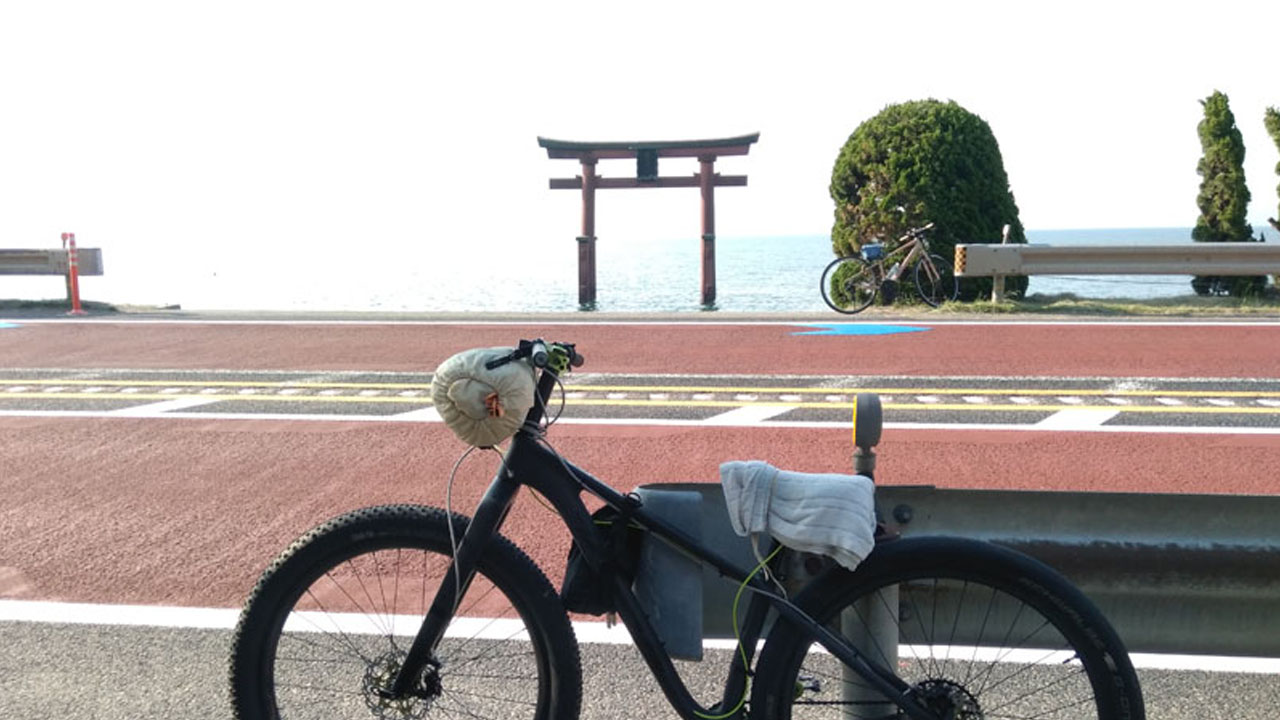
⚠️ Lake West & South: Traffic conditions are tight for cyclists. The west side is a major route to Fukushima Prefecture—trucks and large vehicles pass constantly. Few attractions along the way except Shirahige Shrine.
On the other hand, this west lake area is excellent for swimming and BBQ. I've enjoyed lakeside bathing and barbecues here several times with friends. The water is clean.
Semi-Biwaichi: 150km Northern Loop
The northern loop course, omitting the congested areas south of Biwako Ohashi Bridge, is the 150km (93 miles) Semi-Biwaichi. The split point is Biwako Ohashi Bridge—motorcycles and cars pay tolls, but bicycles and pedestrians cross free.
In this case, main starting points are either at Biwako Ohashi Bridge—Pierri Moriyama or JR Katata Station. Train cyclists tend toward Moriyama; car transporters head to Katata. There's also a Giant Store in Moriyama.
📍 Route Options Summary
| Route Type | Distance | Time Estimate | Difficulty |
|---|---|---|---|
| Full Biwaichi | 200km / 124mi | 8-15 hours | Moderate to Hard |
| Semi-Biwaichi | 150km / 93mi | 6-12 hours | Moderate |
This Biwako Ohashi Bridge is the only shortcut. The choice is between 200km full loop or 150km northern loop—these are the two Biwaichi route options.
Getting Biwaichi Certification
I don't particularly care about completion certificates or cycling computer records, but for those who value such things, Biwaichi certification and stickers make nice souvenirs.
Certification Process
- Download the app: "Biwaichi Certification System" (びわ湖一周認定システム)
- Create an account: This is legitimate—produced by the general incorporated association "Ring no Kuni Biwako Suishin Kyōgikai"
- Visit checkpoints: Scan posters at designated "Biwaichi Cycling Certification" checkpoints along the route
- Answer quizzes: Simple questions at each checkpoint (minimum 4 required)
Checkpoints are located at various ports, roadside stations (Michi-no-Eki), and information centers. There's no time limit. The certificate issuance fee is ¥1,000. Within 2-3 weeks, your completion certificate, sticker, and pamphlet arrive.
Elevation Profile
Biwaichi is nearly flat. There are no real climbs. Only wind disrupts your pace. The JR Kosei Line frequently suspends service due to descents from Hieizan.
The Only Climb: Shizugatake Tunnel Area
Biwaichi's only climbing section is near the exit of Shizugatake Tunnel in Kohoku. Beyond the tunnel spreads a quiet, photogenic scene. This sign marks approximately the highest point.
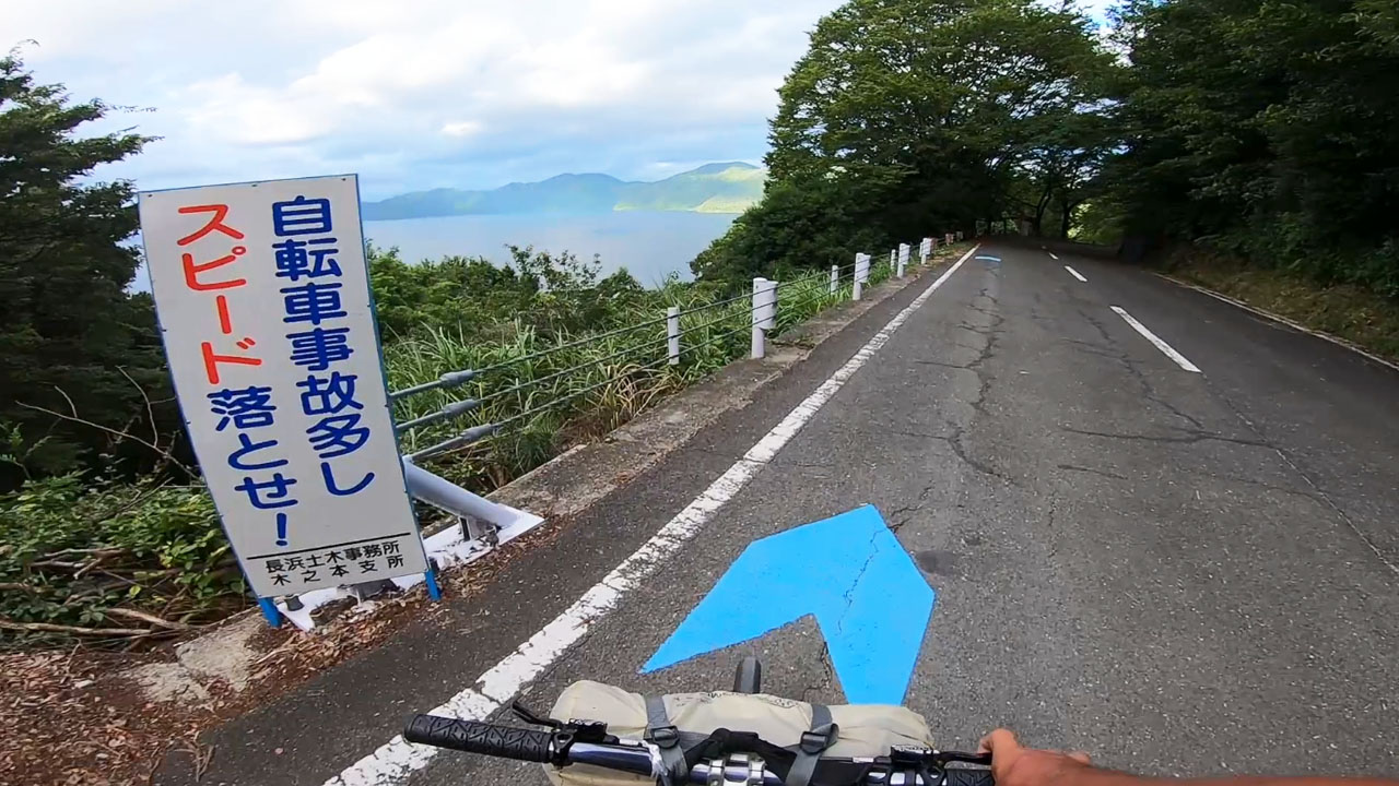
The view opens up dramatically ahead, followed by a straight descent. It's easy to neglect braking and pick up speed. However, there's a merge with the main road ahead—excessive speed is dangerous.
For hill climbers: The nearby Okubiwa Lake Parkway offers challenging climbs—but it's not part of the Biwaichi route.
So, Full Biwaichi elevation gain is at most ~250m (820ft). This differs from Awaichi, which forces you up 1,100m.
Beginner's Guide: Accommodation & Routes
Bicycle cycling and long rides have become more accessible thanks to smartphones and GPS devices. Vending machines and convenience stores help along the way. Japan's cycling environment is "easy mode" by global standards.
However, 100km+ long-distance travel isn't as casual as internet articles suggest. Blogs, YouTube, and SNS aren't complete documentaries—editing makes difficult routes appear simple.
For complete beginners: A one-day 200km Full Biwaichi is not recommended content. Solo, first-time attempts in extreme heat can turn leisure into torture.
Two-Day, One-Night: 150km on a Hybrid Bike
Bicycle calorie consumption for 200km (excluding basal metabolism) is roughly equivalent to a full marathon (42.195km). Attempting this without preparation or experience is reckless.
📏 Distance by Experience Level
- Complete beginners: 50-70km without preparation
- Intermediate riders: Up to 100km manageable
- Recommended for enjoyment: Leave some energy reserve
Even if you can ride 100km, without remaining stamina you can't enjoy good food or beautiful scenery. Only a few niche cyclists prioritize every minute of time—most would rather have Lacolina's Baumkuchen.
Therefore, the itinerary naturally becomes two days, one night. 75km × 2 days = 150km is correct. In other words, Biwahansu (half-Biwaichi) × 2. Enjoy cycling and Shiga Prefecture tourism.
🚴 Recommended Pace
- Speed: 12km/h (7.5 mph) leisurely pace
- Activities: Snacks, meals, sightseeing included
- Physical load: Approximately half-marathon level per day
75km/day isn't that demanding. Even non-athletes and indoor types can manage it somehow.
Bicycle Type Flexibility
With this distance setting, bicycle category doesn't matter. No need for expensive road bikes or e-bikes—regular city bikes work fine. A cross bike with basket and kickstand is optimal.
Recommended Biwaichi Accommodations
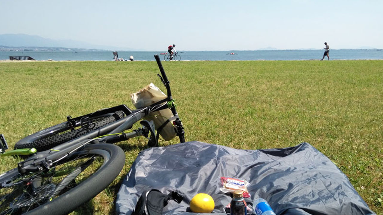
My two Biwaichi were 300km+ long journeys from Osaka: self-ride + full loop + detours. Both were in 30°C+ summer heat. One-day masochist challenges weren't even considered—this was "yuru-camp, yuru-pota" (relaxed camping, relaxed cycling).
Both Biwaichi trips ended up as tent camping overnight stays, but hotels were also planned.
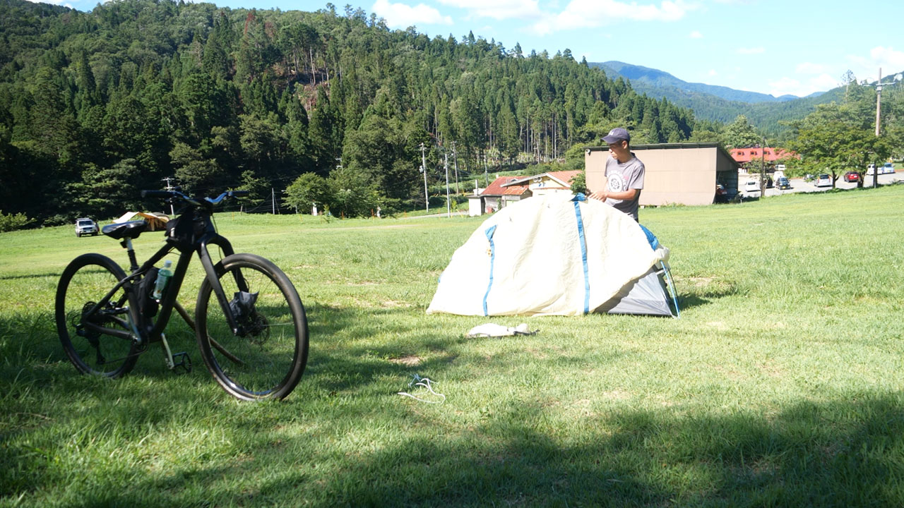
Camping Options
Woody Park Yogo north of Kinomoto,Ski resort in winter, campsite in summer. Bicycle parking costs ¥500—cheap! (2020)
The first Biwaichi two years ago was at a campsite further ahead in Kaizu-Osaki. Same ¥500 rate—cheap! However, Kaizu-Osaki campsite is effectively closed.
Kohoku Area: Resort Territory
Due to Biwaichi starting point considerations, Kohoku accommodations are convenient. This area is a resort zone with stylish hotels and pensions.
🏨 Recommended Accommodations (Kohoku + Nagahama/Imazu)
- Woody Park Yogo - Summer only, camping
- Villa Sansui - Stylish option
- Okubiwa Lake Makino Grand Park Hotel - Solo rider classic
- Imazu Sunbridge Hotel - Bicycles allowed in rooms
Please consider based on budget and purpose. Some hotels offer Biwaichi support plans (free drinks, laundry service,etc).
Safety Warnings for Beginners
Biwaichi is flat, simple, and friendly—basically an easy course. However, there are points and sections requiring caution.
⚠️ Major Accident Zones (Kohoku Area)
- National Route 303 tunnels: Multiple tunnel sections are first-class danger zones
- Saiai and Makino settlements: Pedestrian contact accidents occur frequently
Tunnel safety: Serious bicycle accidents happen annually in Kohoku tunnels. Both beginners and veterans should use back roads or side streets when possible.
Secondary Danger: Lake West
The second danger zone is from Shirahige to Biwako Ohashi Bridge on the west side. This road is a major artery to Fukushima Prefecture on the Japan Sea coast—large vehicles pass at high speed constantly.
🛡️ Safety Checklist
- ✓ Avoid tunnels on Route 303 when possible
- ✓ Use back roads through settlements
- ✓ Extra caution on Lake West arterial roads
- ✓ Wear helmet and reflective gear for night riding
Biwaichi Summary
The full Biwaichi 200km isn't a friendly distance for casual users or even experienced riders. The 150km northern loop around Biwako Ohashi Bridge is recommended for beginners. Enjoy cycling and Shiga Prefecture tourism.
🚴 Route Summary
- Full Biwaichi: 200km / 124mi, challenging for beginners
- Semi-Biwaichi: 150km / 93mi, recommended alternative
- Elevation gain: ~250m (820ft) total—nearly flat
- Only climb: Shizugatake Tunnel area in Kohoku
⚠️ Safety Points
- Kohoku tunnels and settlements—high accident risk
- Lake West arterial roads—heavy truck traffic
- Use back roads when possible
🏨 Accommodation
- Recommended area: Nagahama, Kohoku, Imazu
- Camping option: Woody Park Yogo (¥500)
- Hotel classics: Imazu Sunbridge, Makino Grand Park
📋 Quick Reference
| Full Biwaichi distance | 200km / 124mi |
| Semi-Biwaichi distance | 150km / 93mi |
| Elevation gain | ~250m / 820ft |
| Beginner recommendation | Two-day, one-night (75km × 2) |
Hill climbers: For serious climbing, detour to Ibukiyama or Okubiwa Lake Parkway—not part of Biwaichi but worth exploring.
Frequently Asked Questions
What is Biwaichi?
Biwaichi (ビワイチ) refers to cycling around Lake Biwa, Japan's largest lake in Shiga Prefecture. The name combines "Biwa" (the lake) and "ichi" (one lap), following Japanese cycling tradition like Awaichi (Awaji Island) and Mameichi(Shodoshima).
How long is the Biwaichi route?
Full loop: approximately 200km (124 miles). Semi-Biwaichi (northern half only): approximately 150km (93 miles), starting from Biwako Ohashi Bridge.
What is the elevation gain?
Minimal—approximately 250m (820 feet) total. The route is nearly flat with only one significant climb near Shizugatake Tunnel in the Kohoku area.
Is Biwaichi suitable for beginners?
The full 200km loop is challenging for complete beginners. The recommended approach is a two-day, one-night trip covering 75km per day (150km total), or the Semi-Biwaichi northern route.
How do I get Biwaichi certification?
Use the official "Biwaichi Certification System" app. Visit checkpoints along the route, scan posters, and answer simple quizzes (minimum 4 checkpoints).
What are the main safety concerns?
Kohoku area tunnels on Route 303 have high accident rates. Lake West arterial roads have heavy truck traffic to Fukushima Prefecture. Use back roads when possible and exercise extra caution in these areas.
Where should I stay overnight?
Kohoku area is recommended—Nagahama, Imazu, or Makino. Options range from budget camping (Woody Park Yogo, ¥500) to hotels (Imazu Sunbridge Hotel, Makino Grand Park Hotel).