Kii Peninsula Cycling: Complete Guide to Japan's Largest Peninsula Circuit (2026 Edition)

The Essence of Kii Peninsula Cycling
670km (416 miles), 5,000m (16,400 feet) elevation gain, 3 nights and 4 days.
Add to that: Cape Shionomisaki (Honshu's southernmost point), Ise-Shima National Park's relentless rolling hills, Kumano Kodō UNESCO pilgrimage routes, pristine Pacific coastlines, winter north winds providing tailwind assistance... and you have the essence of Kii Peninsula cycling.
The "※※-Ichi" Cycling Tradition
In Japan, cycling around a specific region is called "※※-ichi" (one lap). The 6 Great Ichi are:
- Awaichi — Awaji Island loop
- Biwaichi — Lake Biwa loop
- Hamaichi — Hamana Lake loop
- Fuji-ichi — Mount Fuji circumnavigation
- Izu-ichi — Izu Peninsula loop
- Kasu-ichi — Kasumigaura Lake loop
The Kii Peninsula circuit, while not traditionally called "Kii-ichi," represents one of Japan's most challenging multi-day cycling adventures. It combines the best elements of coastal riding, mountain climbing, cultural exploration, and endurance testing.
I completed this journey in January 2022 during a three-day weekend (coinciding with Coming of Age Day celebrations). This article introduces a comprehensive guide based on that experience—suitable for serious cyclists planning their own Kii Peninsula adventure.
Route Overview & Statistics
The Kii Peninsula is Japan's largest peninsula, located at the southern tip of Honshu's main island. It spans three prefectures: Wakayama (western side), Mie (eastern side), and parts of Nara (northern edge). The peninsula is home to UNESCO World Heritage sites including the Kumano Kodō pilgrimage routes, pristine coastal scenery, and some of Japan's most dramatic ria coastlines.
🚴 Complete Route Summary
| Day | Route | Distance | Elevation Gain | Difficulty |
|---|---|---|---|---|
| Day 1 | Osaka (Umeda) → Shirahama | ~190 km / 118 mi | ~1,200m / 3,937ft | Moderate (distance) |
| Day 2 | Shirahama → Kumano via Cape Shionomisaki | ~150 km / 93 mi | ~800m / 2,625ft | Easy-Moderate |
| Day 3 | Kumano → Ise via Shima Peninsula | ~160 km / 99 mi | ~1,500m+ / 4,921ft+ | Hard (climbing) |
| Day 4 | Ise → Osaka (via Nara) | ~170 km / 106 mi | Variable | Moderate |
Route Variations
The "Kii Peninsula Circuit" has multiple interpretations depending on your starting point and ambitions:
- Strict peninsula only: ~300 km (186 mi) — Wakayama to Mie, direct route
- Pacific Coast Cycling Road: ~500 km (311 mi) — follows designated cycling road
- Self-powered from Osaka/Kyoto: ~600-700 km (373-435 mi) — includes approach from major cities
I chose the full 670km course including detours to Cape Shionomisaki, lunch stops, grocery runs, and getting lost in Ise. The extra distance provides a more complete experience of the peninsula's diversity.
Day-by-Day Breakdown
📍 Day 1: Osaka to Shirahama (~190 km / ~118 miles)
The Longest Leg
This was my longest single-day ride—approximately 190 kilometers from Umeda in Osaka to Shirahama Beach on the Pacific coast. This route accounts for nearly one-third of the total journey distance.
Why Start with Such a Long Day?
- Early departure: No hotel checkout delays—start from home
- Familiar roads: Osaka to Wakayama City are well-known routes
- Tailwind assistance: North wind provides crucial following wind (especially in winter)
Morning: Urban Escape
Departing at 4:40 AM after an all-nighter, I reached Yodobashi Camera Umeda by 5:00 AM sharp. The early morning streets of Osaka were mercifully quiet—only occasional runners and walkers shared the roads with me.
By 8:00 AM, I'd covered 50 km to Rinku Marble Beach near Kansai International Airport. This coastal stretch offers flat, scenic riding perfect for warming up.
Midday: The Arida Challenge
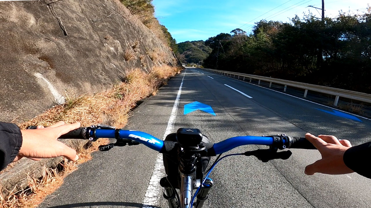
The route transitions to National Route 42—the main artery connecting Wakayama to the Pacific coast. This road also serves as part of Japan's Pacific Coast Cycling Road (太平洋岸自転車道), marked by distinctive blue lanes.
Warning: The approach to Arida from Kainan presents genuine challenges:
- Steep, sustained climbs
- Narrow shoulders with no sidewalks in sections
- Heavy truck traffic
- Ongoing road construction
The Pacific Coast Cycling Road designation doesn't guarantee cyclist-friendly conditions everywhere. Route selection significantly impacts difficulty—sticking to Route 42 is often the hardest but most direct option.
Afternoon: Coastal Riding to Shirahama
South of Arida, Route 42 becomes more manageable with fewer technical challenges. The scenery remains modest—primarily citrus groves rather than ocean views.
Arrival and Accommodation
I reached Shirahama's Shirarai Beach around 4:30 PM—12 hours after departure, or 11.5 hours from passing Umeda.
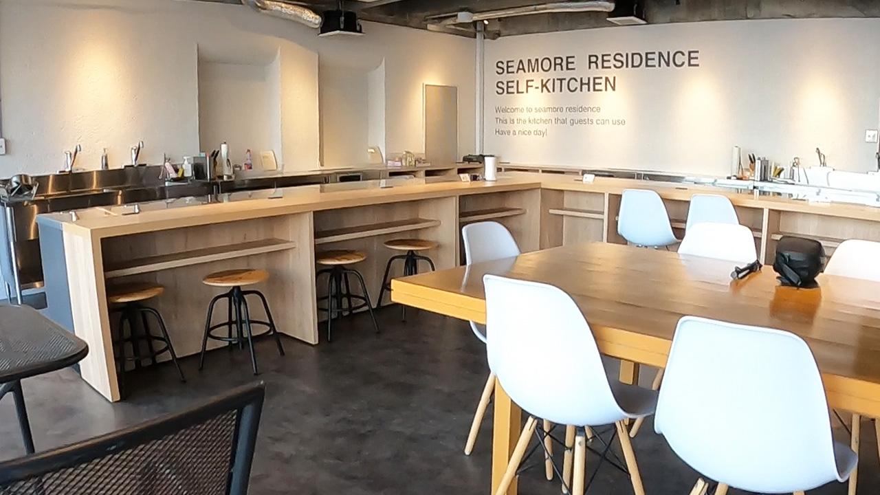
🏨 Hotel: Hotel Seymour Residence (別館)
- Price: ¥6,949 (~$45 USD)
- Features: Self-service kitchen facilities, bike racks and storage, 24-hour access after check-in
- Location: Walking distance to restaurants and convenience stores
📍 Day 2: Shirahama to Kumano via Cape Shionomisaki (~150 km / ~93 miles)
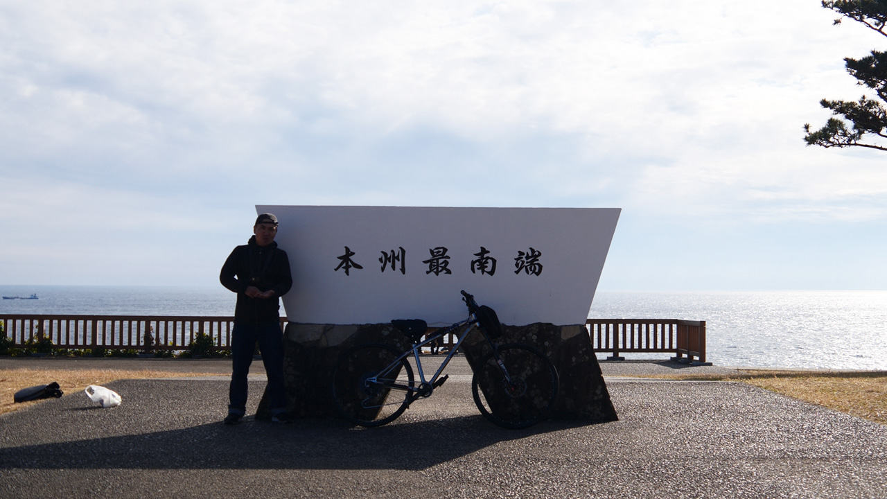
The Southernmost Point of Honshu
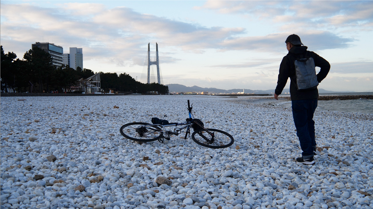
This day takes you to Cape Shionomisaki (潮岬)—the southernmost point of Japan's main island. Every tourist visiting the Kii Peninsula feels compelled to visit this landmark, making it an unavoidable detour for cyclists as well.
Morning: Shirahama Sightseeing
Before hitting Route 42 again, I stopped at Senjōjiki (千畳敷)—a stunning natural rock formation resembling a tatami mat floor extending into the ocean. Other nearby attractions include San'dan-gaki cliffs and Adventure World theme park, each about 3 km from the beach.
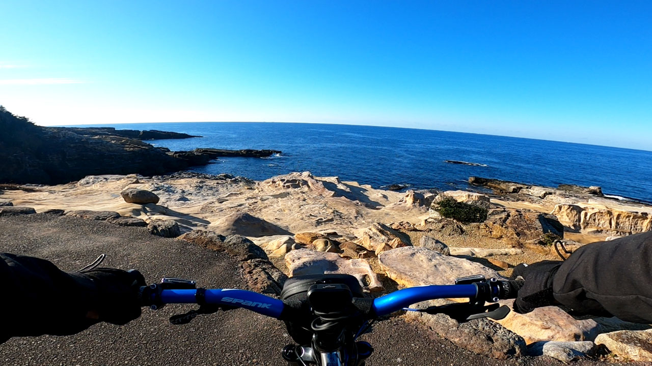
Midday: Kushimoto and Cape Shionomisaki
The Shirahama-to-Kushimoto stretch is nearly flat coastal riding—part of both the Pacific Coast Cycling Road and WAKAYAMA800 stamp rally route. Very comfortable cycling conditions.
Cape Shionomisaki Loop:
- Distance: Approximately 15 km (9.3 mi)
- Elevation: Surprising ups and downs
- Time needed: About 90 minutes including lunch stop
The cape features:
- Lighthouse and observation tower (restaurant reviews are mixed)
- Beach park ideal for picnics or camping
- Stunning Pacific views year-round
Lunch Recommendation:
I grabbed pressed mackerel sushi at a local cooperative store near the cape base—simple, fresh, and perfect for refueling.
Afternoon: Heading to Kumano
After Kushimoto, Route 42 turns northeast toward Shingu and Kumano. This is where my reliable north wind tailwind disappeared—I was now heading into it. The consolation? Route 42 remains flat and straightforward.
🍜 Regional Specialties:
- Taiji: Whale watching and cuisine
- Tanabe: Kuroame (black licorice candy)—high-calorie cycling fuel
- Shingu: Pressed sushi (oshi-zushi)
Arrival in Kumano
I reached JR Kumano City Station around 6:30 PM, then backtracked slightly to stop at AEON for snacks before arriving at Hotel Nami in Onigajo Castle area by 7:00 PM.
Important Note: A tunnel on Route 42 just before Kumano prohibits pedestrian and bicycle traffic. Use the parallel Onigajo Pedestrian Tunnel as an alternative route.
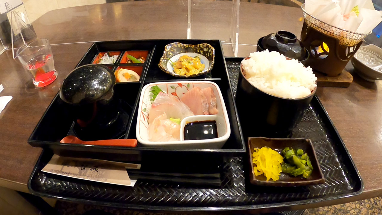
🏨 Accommodation: Hotel Nami
- Price: ~¥8,000 (~$52 USD)
- Type: Only meal-included stay of the trip
- Dinner: Local seafood—exceptional quality
📍 Day 3: Kumano to Ise via Shima Peninsula (~160 km / ~99 miles)
The Most Challenging Day
This day features the Ise-Shima National Park—the most technically demanding section of the entire Kii Peninsula circuit. Expect relentless rolling hills, tunnels, and limited ocean views despite being on a coastal route.
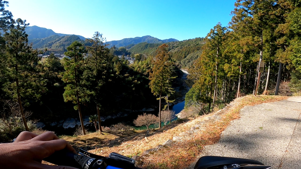
Morning: Kumano Hill Climb
Starting from Hotel Nami at the junction of Routes 42 and 311 (north of Onigajo Castle World Heritage Site):
Both converge at Owari City. I chose Route 42 despite the -3°C morning temperature—fingers and toes went numb quickly.
Tunnel Warning: Two long tunnels (approximately 2 km each) appear before descending to Owari. These are surprisingly warm in winter but require caution due to limited traffic awareness.
Midday: Kii-Nagashima Rest Stop
After devouring breakfast cake (I ate about 10 pieces—no hunger pangs all day), I stopped at Michi-no-Eki Manbō (Roadside Station Manta) in Kii-Nagashima. The station features a large pond and park area—perfect for rest breaks.
The Specialty:
Manta ray fried rice set, but I opted for soft-serve ice cream instead. The station was surprisingly busy despite the winter season.
Afternoon: Ise-Shima National Park Hell
This section lives up to its reputation as the trip's hardest challenge. The Shima Peninsula features a ria coastline—deeply indented bays and inlets that force roads inland, creating an endless cycle of: bay → climb → tunnel → descent → repeat.
The Reality:
- Individual climbs: Modest (30-50 meters)
- Cumulative effect: Relentless—approximately 18 tunnels from Manbō to Shima alone
- Total climbing estimate: ~1,500m for this section
- Ocean views: Rare and fleeting
- Experience: Essentially a natural interval training course
Late Afternoon: Arrival in Ise
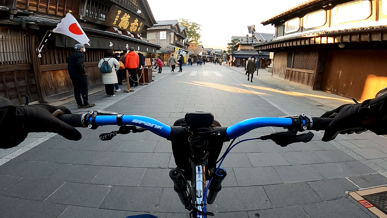
By late afternoon, I reached Okage Yokocho (おかげ横丁)—the shopping street near Ise Jingu Shrine. This was mid-holiday weekend, so crowds were intense.
🍡 Food Notes:
- Akafuku mochi shop: Had a massive queue (available at Osaka Station and department stores)
- Butasute(豚捨): Famous for croquettes, I bought just one to-go.Good!
- The Yokocho's sweet beens soup: Extremely sweet
📍 Day 4: Ise to Osaka (via Nara) (~170 km / ~106 miles)
The Return Journey
The final day brings you back from the spiritual heart of Japan to the urban sprawl of Osaka. This route passes through Nara Prefecture, offering a different perspective on the peninsula's northern edge.
Route Options:
Key Considerations:
- Fatigue management: Four consecutive days of riding takes its toll—recovery is approximately 5% per day
- Sun position: Heading west means chasing the sunset, extending daylight hours slightly
- Train backup: Multiple JR and Kintetsu stations provide escape routes if needed
Arrival in Osaka:
The journey ends where it began—at Umeda or your chosen destination in the Osaka metropolitan area. Total distance covered: approximately 670 km (416 miles) over four days.
Key Attractions & Landmarks
🗼 Cape Shionomisaki (潮岬)
Honshu's southernmost point with lighthouse, observation tower, and stunning Pacific views. A pilgrimage site for cyclists and tourists alike.
🏛️ Kumano Kodō (熊野古道)
UNESCO World Heritage pilgrimage routes. Some sections may be accessible by gravel/MTB—research required.
🌊 Ise-Shima National Park
Dramatic ria coastline with relentless rolling hills. One of Japan's three great ria coastlines.
⛩️ Ise Jingu (伊勢神宮)
Japan's most sacred Shinto shrine complex. Okage Yokocho shopping street nearby.
🚂 Shimakaze Limited Express
Kintetsu's premium train service with reclining seats—highly recommended for Osaka-Ise round trips if combining train + bike.
Route Variations & Flexibility
The Kii Peninsula circuit offers flexibility for different fitness levels and time constraints:
| Variation | Distance | Duration | Best For |
|---|---|---|---|
| Strict Peninsula Only | ~300 km / 186 mi | 2-3 days | Experienced cyclists wanting core experience |
| Pacific Coast Cycling Road | ~500 km / 311 mi | 3-4 days | Cyclists following designated routes |
| Full Circuit (This Guide) | ~670 km / 416 mi | 4 days | Serious endurance cyclists |
| Segmented Approach | Variable | Multiple trips | Beginners or those with limited time |
Segmented Approach Recommendations:
Train + Bike Option: Use JR/Kintetsu lines to reach starting points. The Shimakaze Limited Express (Kintetsu) offers premium service with reclining seats—highly recommended for Osaka-Ise round trips.
Weather & Wind Considerations
Wind direction is critical—plan your route direction based on seasonal patterns.
🌬️ Seasonal Wind Patterns
| Season | Dominant Wind | Recommended Direction | Notes |
|---|---|---|---|
| Winter (Dec-Mar) | North wind | Counter-clockwise | Tailwind advantage on Pacific coast; clear skies |
| Spring/Autumn | Variable (West) | Either direction | Milder temperatures, more variable conditions |
| Summer (Jun-Sep) | Southeast monsoon | Clockwise | Heat, humidity, typhoon risk |
My Observation:
The cycling community convention suggests clockwise for islands/peninsulas and counter-clockwise for lakes—but this ignores seasonal wind patterns. My observation: approximately 90% of cyclists chose counter-clockwise in winter.
Winter Strategy: I deliberately chose a day with north wind at 5m/s, planning the entire route around it. The result? Tailwind assistance for most of Day 1 and early Day 2—making 190km feel manageable.
Temperature Considerations:
- Winter mornings: Can drop below freezing in mountain passes (Day 3: -3°C at 9 AM)
- Pacific coast: Generally milder than Japan Sea side
- Summer: High heat and humidity—early starts essential
Accommodation Recommendations
Strategic overnight stops are crucial for managing the 670km distance. Here are my recommendations by region:
📍 Shirahama Area (Day 1)
- Price: ~¥7,000 (~$45 USD)
- Type: Budget stay with kitchen facilities
- Features: Self-service kitchen, bike racks, 24-hour access
- Best for: Solo cyclists, budget-conscious travelers
Other options: Various hotels and pensions available—flexible outside peak season.
📍 Kumano/Shingu Area (Day 2)
- Price: ~¥8,000 (~$52 USD)
- Type: Business hotel with meals
- Features: Dinner included, local seafood
- Best for: Cyclists wanting meal convenience
Note: Shingu or Owi are more urban than Kumano City—better for post-check-in exploration.
📍 Ise Area (Day 3)
- Price: Variable (¥6,000-15,000)
- Type: Business hotels, ryokans
- Features: Close to main attractions, train access
- Best for: Final night before return journey
Avoid Okage Yokocho area during holidays—extremely crowded.
Booking Tip: Accommodation is flexible outside peak seasons (summer, Golden Week, New Year). During holidays, book well in advance.
Comparison with Other Japanese Routes
The Kii Peninsula circuit represents a different tier of challenge compared to Japan's famous cycling loops. Here's how it compares:
| Kii Peninsula | Awaichi (Awaji) | Biwaichi (Lake Biwa) | |
|---|---|---|---|
| Distance | 670km / 416mi | 150km / 93mi | 200km / 124mi |
| Elevation Gain | ~5,000m / 16,400ft | 1,100m / 3,609ft | 250m / 820ft |
| Duration | 4 days | 1-2 days | 1 day |
| Difficulty | Hard | Moderate-Hard | Easy-Moderate |
| Access | ○ (Good) | △ (Fair - ferry dependent) | ◎ (Excellent) |
| Road Surface | ○ (Good) | ○ (Good) | △ (Fair - variable) |
| Tourism | UNESCO sites, Cape Shionomisaki, Ise-Shima, Kumano Kodō | Onokoro Park, Dragon Quest, Hello Kitty Smile, Hotel New Awaji | Lake Biwa, Hikone Castle, Shirahige Shrine, Otsu |
| Cuisine | Fresh seafood, citrus fruits, Kumano specialties | Octopus, onions, Awaji beef, Awaji nori | Mackerel, sweetfish, baumkuchen, Omi rice, Omi beef |
| Recovery Options | △ (Limited in remote sections) | ✗ (No trains on island) | ◎ (Extensive train network) |
Key Takeaways:
- Kii Peninsula is a multi-day endurance challenge—significantly harder than single-day routes
- Awaichi packs more elevation into shorter distance but lacks recovery options (no trains)
- Biwaichi is the most beginner-friendly with extensive train backup and minimal climbing
Summary for Cyclists
The Kii Peninsula circuit offers an authentic taste of Japan's cycling culture, stunning coastal scenery, and challenging terrain that tests endurance without requiring technical mountain biking skills. The combination of flat Pacific coast sections with the rolling hills of Ise-Shima creates variety throughout the journey.
🚴 Route Summary
- Total Distance: 670km / 416mi over 4 days
- Elevation Gain: ~5,000m / 16,400ft total
- Hardest Section: Ise-Shima National Park (~1,500m climbing)
- Best Season: Winter (Dec-Mar) for clear Pacific skies and tailwind assistance
⚠️ Difficulty Points
- Ise-Shima National Park—relentless rolling hills
- Limited recovery options in remote sections
- Night riding on rural roads—avoid if possible
- Heavy truck traffic on Route 42
✨ Highlights
- Cape Shionomisaki—Honshu's southernmost point
- Kumano Kodō UNESCO pilgrimage routes
- Pristine Pacific coastlines
- Fresh seafood throughout the route
- Ise Jingu spiritual experience
Key Takeaways
- Wind direction is critical—plan your route direction based on seasonal patterns. Counter-clockwise in winter provides tailwind advantage.
- Ise-Shima National Park is the hardest section—allow extra time and energy. It's essentially a natural interval training course with ~1,500m of relentless rolling hills.
- Cape Shionomisaki detour adds ~50km but is worth it for the experience of reaching Honshu's southernmost point.
- Accommodation booking recommended during holidays; flexible otherwise. Shirahama, Kumano/Shingu, and Ise are key overnight areas.
- Night riding on rural roads—avoid if possible; plan to finish before sunset. Local truck traffic is a significant hazard after dark.
Final Recommendation
This route offers one of Japan's most rewarding multi-day cycling experiences. The combination of coastal beauty, cultural depth (UNESCO sites, pilgrimage routes), and genuine physical challenge makes it memorable for serious cyclists.
For those unable to commit to the full circuit:
- Day trip: Osaka → Shirahama (return by train)
- Weekend: Shirahama → Kushimoto → Kumano (2 days)
- Extended: Full 4-day circuit as described here
📋 Quick Reference
| Total Distance | 670km / 416mi (4 days) |
| Elevation Gain | ~5,000m / 16,400ft total |
| Best Season | Winter (Dec-Mar) for clear skies + tailwind |
| Hardest Section | Ise-Shima National Park (~1,500m climbing) |
| Key Overnight Areas | Shirahama, Kumano/Shingu, Ise |
| Recommended Direction | Counter-clockwise (winter) |
Key difference from shorter routes: The Kii Peninsula circuit is a genuine multi-day endurance challenge. Unlike Biwaichi or Awaichi, it requires serious preparation, accommodation planning, and self-reliance in remote sections.
Frequently Asked Questions
What is the Kii Peninsula cycling route?
The Kii Peninsula circuit is a 670km (416 mile) multi-day cycling route around Japan's largest peninsula, spanning Wakayama and Mie prefectures. The route features UNESCO World Heritage sites including Kumano Kodō pilgrimage routes, pristine Pacific coastlines, Cape Shionomisaki (Honshu's southernmost point), and the challenging Ise-Shima National Park with its ria coastline terrain.
How difficult is it compared to other Japanese cycling routes?
The Kii Peninsula circuit is significantly more challenging than single-day routes like Biwaichi (Lake Biwa, 200km/250m elevation) or Awaichi (Awaji Island, 150km/1,100m elevation). At 670km with approximately 5,000m of elevation gain over 4 days, it requires serious endurance training. The Ise-Shima National Park section alone features ~1,500m of relentless rolling hills—essentially a natural interval training course.
What's the best time of year to cycle the Kii Peninsula?
Winter (December-March) offers clear skies on the Pacific side while Japan Sea coast experiences heavy snow. North winds provide tailwind assistance for counter-clockwise riders. However, temperatures can drop below freezing in mountain passes. Spring and autumn offer milder weather but more variable conditions. Summer brings heat, humidity, and typhoon risk.
Can beginners attempt this route?
The full 670km circuit requires serious preparation and endurance training. Beginners should consider: (1) Breaking it into multiple trips, (2) Using train connections between segments, or (3) Starting with shorter routes like the strict 300km peninsula-only circuit from Wakayama to Mie. The route has limited recovery options in remote sections—self-reliance is essential.
What equipment do I need?
A touring setup with wider tires (28-35mm), adequate gearing for climbs, and panniers or frame bags for luggage is recommended. For this trip, I used a custom mountain bike with high-rise handlebar and dropper seatpost—comfortable but heavy. Most cyclists could manage with under 5kg total luggage.
How do I handle accommodation?
Key overnight areas: Shirahama (Day 1), Kumano/Shingu area (Day 2), and Ise (Day 3). Options range from budget hotels with kitchen facilities to business hotels with meals. Book in advance during holidays; flexible otherwise.
What about food and supplies?
Fresh seafood is consistently excellent throughout the route. Convenience stores are sparse in remote sections (e.g., only 2 in 50km between Shirahama-Kushimoto). Plan meals strategically—self-cooking options available at some accommodations.
Is night riding safe?
Rural roads become dangerous after dark with limited lighting and heavy truck traffic. Plan to finish before sunset whenever possible. If night riding is unavoidable, use powerful lights and exercise extreme caution.