Mameichi: The Ultimate Guide to Cycling Shodoshima Island (2026 Edition)
In Japan's cycling culture, island loops have catchy names: Biwaichi for Lake Biwa, Awaichi for Awaji Island.
So what do you call a loop around Shodoshima in the Seto Inland Sea?
Mameichi ✓
"Why not?!" I thought every time I considered tackling Mameichi. But as someone prone to seasickness, I kept hesitating at the ferry terminal—until finally landing on this soy sauce-famous island in March 2025.
This completes my conquest of the Seto Inland Sea alongside Awaichi, Shimanami Kaido, and Setoichi. My dream of becoming Pirate King is just a matter of time.
Below I share how to reach Shodoshima from the Hanshin area, recommended Mameichi routes, local cuisine, and must-see attractions.
Mameichi Overview
The "mame" in Mameichi comes from Shodoshima's name (小豆島), but it's pronounced neither "azukijima" nor "komamejima"—it's "Shōdoshima".
🏝️ Island Specialties
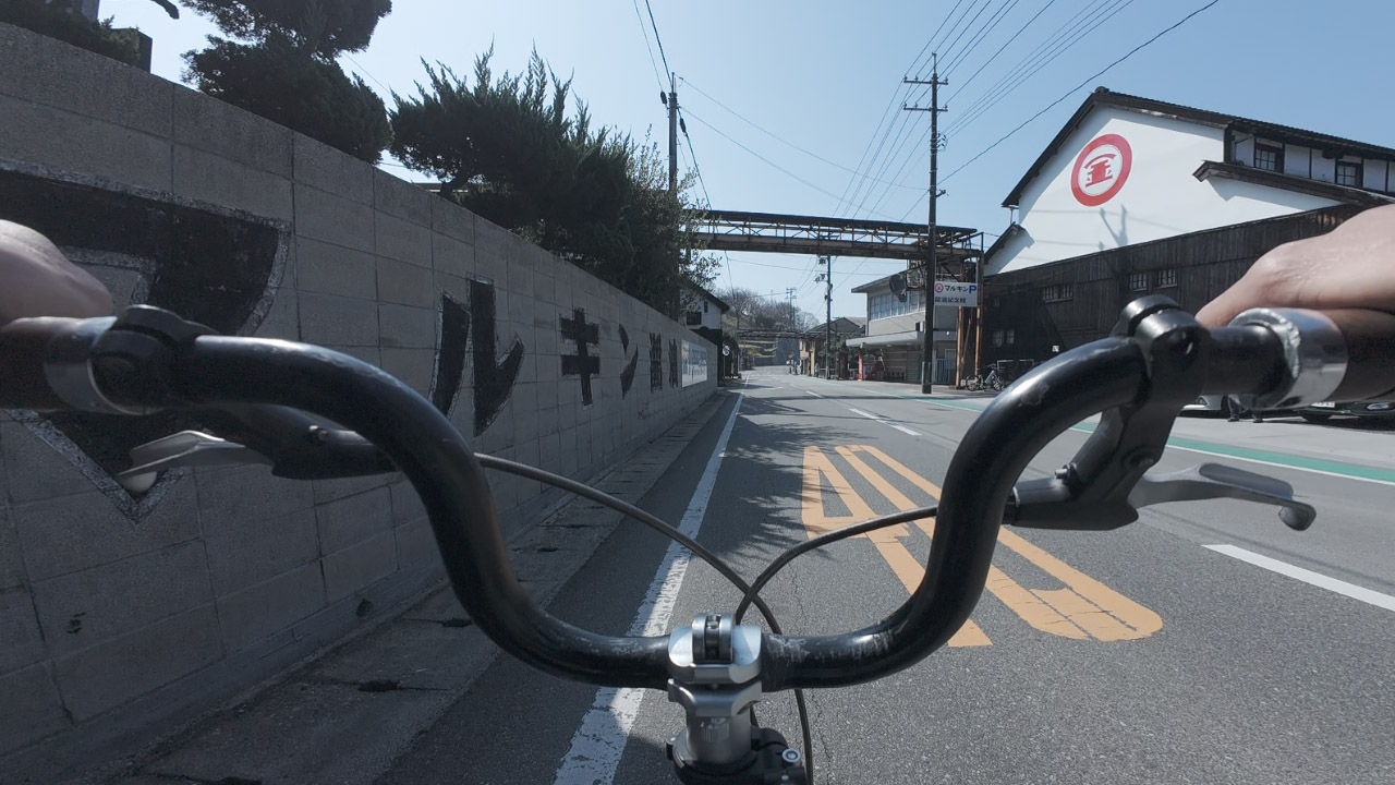
- Soy sauce - Marukin brand originated here
- Olive oil - Japan's first olive plantation (1908)
- Anime pilgrimage - "Karakai Jouzu no Takagi-san" setting
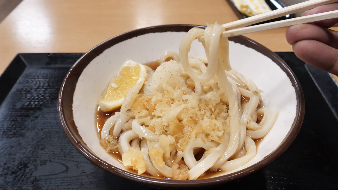
- Somen noodles - Surprisingly, not udon despite being in Kagawa Prefecture!
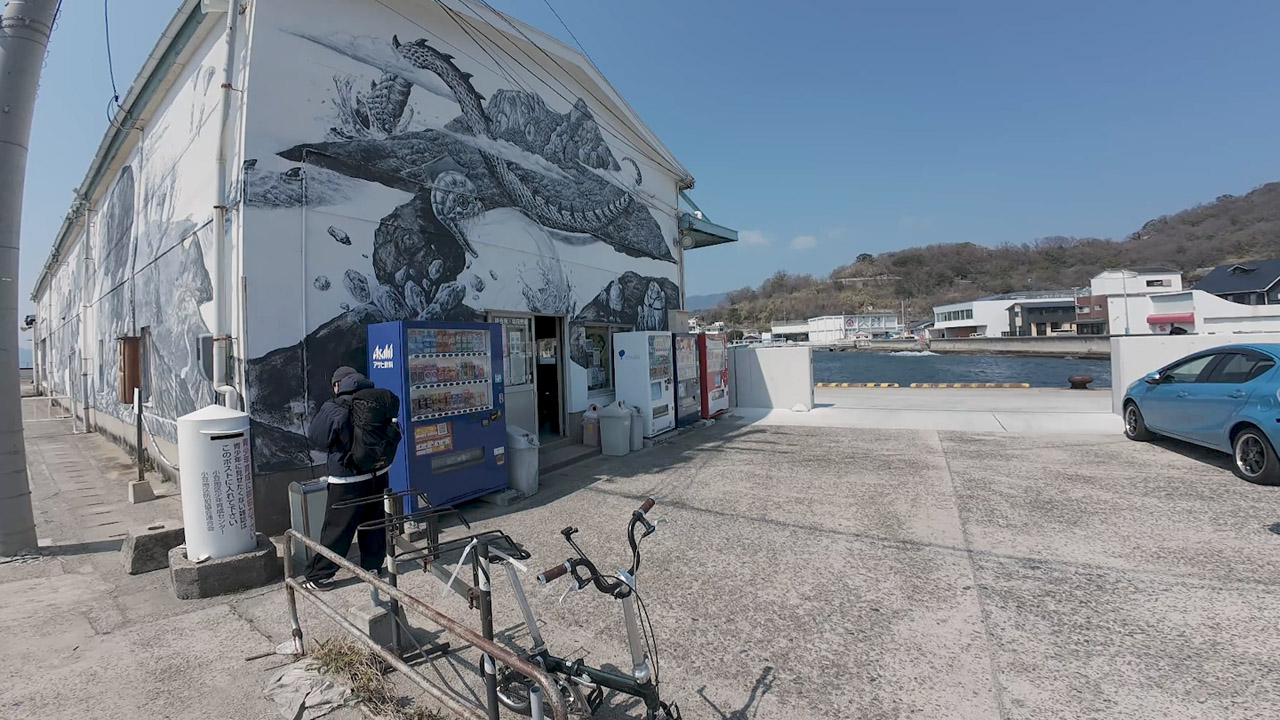
This is a major soy product region. The Marukin brand was born here. Near Sakai Port, the Soy Sauce Museum and warehouse district waft with the aroma of moromi (fermented mash).
Access to Shodoshima
The battle for Mameichi begins before you even reach the island. Access is limited, and from the Kansai region there are only 3 weekday sailings or 4 on weekends/holidays.
Main Ferry Routes
- Kobe → Sakai (Jumbo Ferry)
- Himeji → Fukuda
- Takamatsu → Teshima / Ikeda / Uchiumi / Sakai
- New Okayama → Teshima
Takamatsu is within commuting distance, with ferries departing from multiple ports. In contrast, Kansai ferries are primarily tourist-focused. The direct Kobe-Sakai route takes approximately 3 hours 30 minutes.
My Journey (Osaka → Shodoshima)
- Ride bicycle from home to Hankyu Jūsan Station
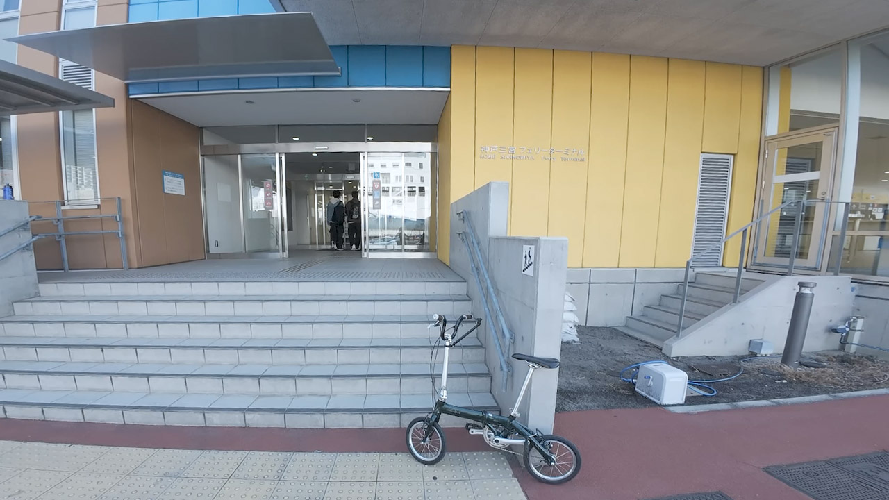
- Train with bike bagged to Hankyu Sannomiya Station
- Ride from Sannomiya to Kobe Port Terminal (1.5km)
- Jumbo Ferry to Sakai Port, Shodoshima
- Mameichi begins!
That's about two cycles of disassembly and reassembly before even starting Mameichi. I brought a single-speed folding bike expecting this—but the island's frequent elevation changes defeated me.
Whether taking a bus or riding from the station, budget an additional 15 minutes. Total door-to-Mameichi time from Osaka: approximately 6 hours.
Ferry Costs & Pricing
Here's the Jumbo Ferry pricing (Kobe departure, weekday morning sailing as of late March 2025):
| Category | Price (¥) |
|---|---|
| General passenger, free seating | 1,990 |
| Bicycle | 500 |
| Total (one-way) | 2,490 |
The Kobe-Takamatsu and Kobe-Shodoshima fares are identical. Same price whether on the older Ritsurin 2 or newer Aoī vessel.
Additional Charges
The tricky part is that "~" in the pricing—it varies significantly by conditions, especially timing:
| Condition | Additional Cost (¥) | Notes |
|---|---|---|
| Overnight departure (1:00 AM) | +340 | Route becomes Kobe→Takamatsu→Shodoshima, 6.5 hours total |
| Weekend/Holiday | +340 | Reduced from ¥500 as of July 2025 |
| Fuel surcharge | ¥0-400 | Variable, applies to all passengers since July 1, 2025 |
| Bicycle (non-folded) | +500 | Fold and bag it for free carry-on treatment |
Example: Weekend overnight departure (full price)
¥1,990 + ¥340 (weekend) + ¥340 (overnight) + ¥500 (bicycle) = ¥3,170 + fuel surcharge
Savings Tips
- Fold your bicycle into a bag = Carry-on luggage treatment (¥0)
- Online booking = ¥100 discount
- Round-trip ticket = ¥100 discount
Designated seats and private rooms cost significantly more. The Aoī also features a "Cycle Pit" for displaying your bike—perfect for satisfying that approval-seeking urge.
⚠️ Price Change: July 1, 2025
The Jumbo Ferry's fuel surcharge was previously free for general passengers and cyclists—but from July 1, 2025, it applies to everyone.
Net effect: Weekend/holiday trips became slightly cheaper (¥500 → ¥340 surcharges), while weekday trips are marginally more expensive due to the new fuel charge.
The Budget-Friendly Triangle Ticket
Honestly, I felt Mameichi alone lacked punch. Wanting a more technical cycling trip, I skipped the round-trip online booking and purchased a triangle ticket instead.
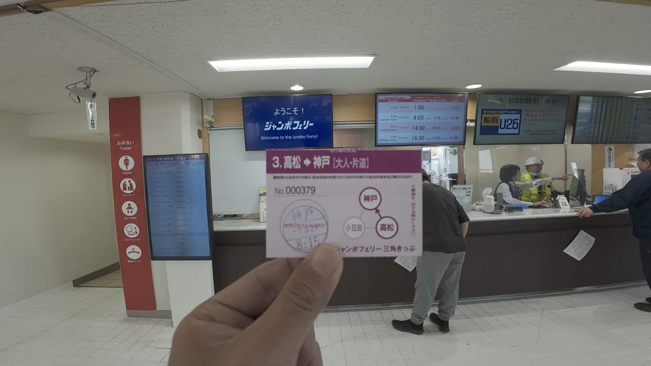
This special ticket is sold only at the Kobe terminal. Choose your outbound destination: Shodoshima or Takamatsu.
I took the red route, combining Mameichi with a Takamatsu sightseeing stop.
Triangle Ticket Pros & Cons
| Triangle Ticket Analysis | |
|---|---|
| Price | ¥3,790 (cheaper than round-trip) |
| Advantages | Visit two destinations; authentic Sanuki udon in Kagawa |
| Disadvantages | No online booking; ¥370 bicycle fee for Shodoshima-Takamatsu leg (if not folded) |
If you want to eat authentic Sanuki udon on the Kagawa mainland, buy a triangle ticket.
My experience: Weekday outbound, Saturday return. Additional charges totaled only ¥500 (return weekend surcharge). Note: Shodoshima-Takamatsu leg doesn't incur weekend fees.
Jumbo Ferry Crowding Levels
On budget long-distance trips, securing a seat is critical. We're not Arab oil sheikhs who can afford designated seats or private rooms. Should penny-pinching cyclists pay premium fares? Absolutely not.
Crowding by Route
- Kobe → Sakai (outbound): Full capacity on weekday morning Aoī. No floor space or benches available. Lots of young couples...
- Sakai → Takamatsu (day 2, afternoon): Nearly empty
- Takamatsu → Kobe (night): About 70% full
The older Ritsurin 2's floor space seemed larger than the new Aoī.
WiFi Warning: Don't count on it. Constantly congested and slow. Starlink is for premium seats only. Mobile data works fine along the Seto Inland Sea coast, though.
Cycling Conditions on Shodoshima
I've rambled about ferries long enough—time for the main event: Mameichi.
Shodoshima Profile
- Distance: Short-ish (~100km full loop)
- Elevation: Frequent ups and downs
- Wind: Strong westerlies
Not a bean—more like a small, spicy sansho pepper.
Mameichi Distance & Elevation
The coastline measures 126km including all the jagged peninsulas. A coastal road loop is approximately 100km.
I planned to cross from Shodoshima to Takamatsu on day two, so I booked accommodation in Teshima (west side) considering udon pilgrimage time and return ferry scheduling.
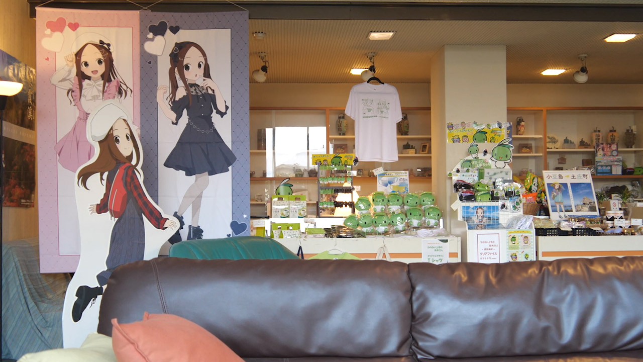
The original manga author is from Shodoshima, and the story is set here. Anime pilgrimages are thriving—lots of young couples.
My Route Breakdown
| Day | Route | Distance | Elevation Gain |
|---|---|---|---|
| Day 1 | Sakai → (north coast) → Teshima | ~40km | ~500m |
| Day 2 | Teshima → Sakai (south coast) | ~17km | Moderate |
| Total | ~60km (partial loop) | ||
Tackling all the peninsulas adds ~10km each, approaching a full 100km Mameichi.
However, elevation changes occur regularly throughout. Port → pass → port → pass loop. I flashed back to Ise-Shima's coastline in Mie Prefecture.
Route Details: North vs. South Coast
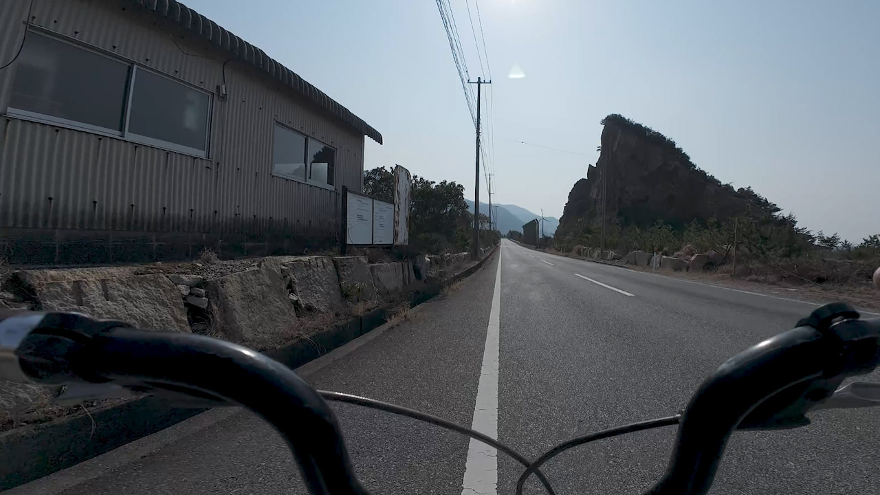
🌊 North Coast Route (Hard)
- Character: Soy sauce aroma on east side; barren zone on north
- Elevation: ~500m gain over 40km
- Wind: Strong headwinds (westerlies)
- Services: Minimal—1-2 restaurants at ports, one roadside station
- Difficulty: Advanced riders only
🏖️ South Coast Route (Recommended)
- Character: Scenic, tourist-friendly
- Elevation: Moderate, manageable
- Wind: Tailwinds on return leg
- Services: Abundant restaurants, shops, attractions
- Difficulty: Beginner to intermediate friendly
Wind turbines are placed where wind direction and strength remain stable year-round—like Awaji Island's west side. On the counter-clockwise route, this is maximum headwind territory. Can't even coast downhill...
Kankaikei Gorge Warning
⚠️ Kankaikei Branch: 9km with 600m climbing. Avoid unless you're a serious climber.
Teshima: Resort Territory
My recent Awaji trip was quite resort-like, with stylish west coast spots.
Shodoshima isn't as polished. It felt more Showa-era and rural than expected—especially around Sakai Port, where the Soy Sauce Museum is nearly the only attraction.
Teshima on the west side (near Takamatsu) transforms into resort territory overnight: supermarkets, drugstores, anime pilgrimage sites, hot springs, hotels, and international visitors. Ah yes, tourist destination.
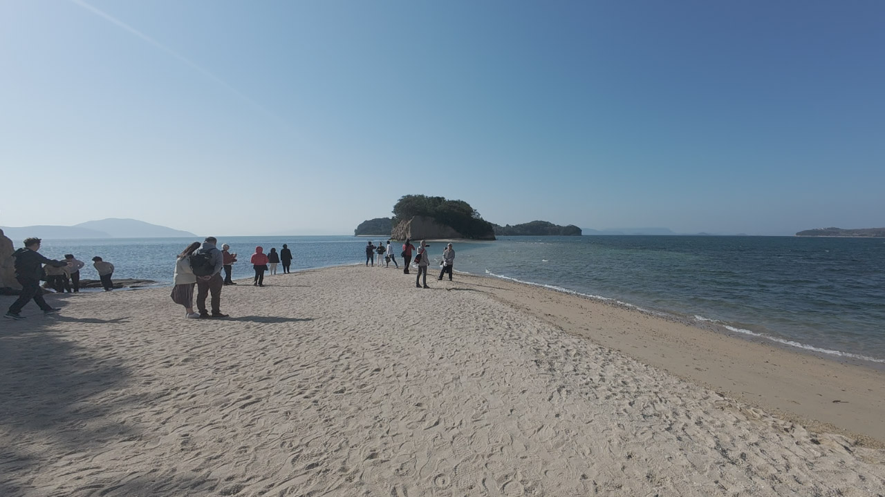
Angel Road
The island's most popular spot. At low tide, a single path emerges from beach to rocky outcrop.

Tide timing: Check the Shodoshima Ferry Tide Table. For crossing to the rocks, verify beforehand: shikokuferry.com/angel
Unfortunately, both evening of day one and morning of day two were high tide.
Southern Route Highlights
Day two, heading from Teshima to Sakai: the southern route offered abundant attractions, restaurants, minimal elevation changes, and favorable tailwinds.
Rental bike recommendation: Take this route. The north side is an advanced hardcore course—not particularly enjoyable for casual riders.
Food & Services
- Udon shops: Almost none (surprisingly)
- Somen noodles: Island specialty
- Nori seaweed: Local product—佃煮 (tsukudani) is genuinely delicious
- Bicycle shops: Virtually non-existent
Called "geta" in Shodoshima and Okayama. But isn't it more like "zōri"? 🤔
Road Conditions
- Varying road surfaces and traffic conditions
- Less cyclist-friendly than Awaji or Lake Biwa areas
- Low local bicycle usage rate
- Tourist cyclists outnumbered locals significantly
The peninsula interiors remain unexplored in this trip, but Google Maps suggests barren port-pass loops.
Easiest accessible area: Around "Twenty-Four Eyes" movie village. Wandering along National Route 436 on the south side offers the most enjoyable cycling experience.
Mameichi Summary
Actually, this is more of a Jumbo Ferry summary.
🚢 Ferry Access
- Ferry-only access (no bridges)
- Pricing doubles with timing/options
- Sakai Port renovated beautifully
- Fuel surcharge from July 1, 2025
- Triangle ticket offers best value
- Jumbo Ferry runs late (locally notorious)
🚴 Island Cycling
- North coast: Hard, challenging
- South coast: Recommended for most riders
- Bicycle shops: virtually none
- Udon shops: almost non-existent (somen instead)
- Teshima = resort area
Final Recommendations
For serious distance: Take the overnight ferry, tackle Mameichi as a day trip.
For relaxed riders: Bring a folding bike for just the south coast, OR rent locally and stay one night in Teshima.
📋 Quick Reference
| Ferry (Kobe-Sakai) | 3.5 hours, ¥2,490 base + extras |
| Mameichi distance | ~100km full loop, ~60km partial |
| Best route | South coast (clockwise from Sakai) |
| Must-see | Angel Road, Marukin Museum, Olive Park |
Frequently Asked Questions
What is Mameichi?
Mameichi (マメイチ) refers to cycling around Shodoshima Island in Japan's Seto Inland Sea. The name combines "mame" (bean - from the island's name 小豆島) and "ichi" (one lap), following Japanese cycling tradition like Biwaichi (Lake Biwa) and Awaichi (Awaji Island).
How do I access Shodoshima by bicycle?
Shodoshima is a complete island with no bridges. Access is ferry-only, primarily via the Jumbo Ferry from Kobe to Sakai Port (3.5 hours). Other routes exist from Takamatsu, Himeji, and Okayama.
What are the ferry costs?
Base fare from Kobe: ¥1,990 (passenger) + ¥500 (bicycle) = ¥2,490 one-way. Additional charges apply for weekends (+¥340), overnight departures (+¥340), and fuel surcharges (¥0-400). Round-trip or triangular tickets offer savings.
How difficult is the Mameichi route?
Moderate to challenging. The island features frequent elevation changes, strong westerly winds (especially on the north coast), and limited services. North route: ~40km with 500m climbing. Full loop: ~100km including peninsulas.
What are the must-see attractions?
Angel Road (tide-dependent), Marukin Soy Sauce Museum, Olive Park, Kankaikei Gorge (challenging climb), and the anime pilgrimage site for "Karakai Jouzu no Takagi-san". The south coast offers better cycling conditions.