Osaka City Cycling: A Complete Urban Tour Guide (2026 Edition)

Welcome to my model course for sightseeing cycling around Osaka city. This route covers the essential highlights—from historic castles to neon-lit entertainment districts, all connected by bike.
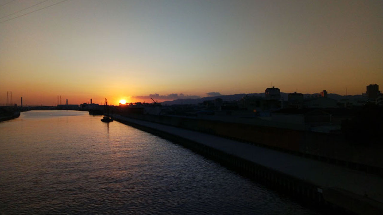
Starting Point: Shin-Midosuji
The journey begins at Shin-Midosuji, just a 5-minute ride from my place along the Sakaisaka River.
📍 Route Basics
- Start Time: 12:30 PM
- Total Duration: ~5 hours
- Difficulty: Easy to moderate (urban cycling)
- Best Season: Spring or autumn
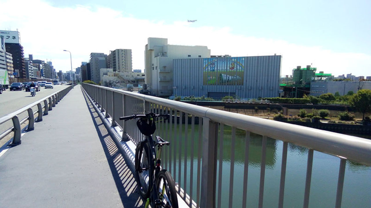
On the near side of the river lie Suita and Toyonaka cities; across lies Osaka proper. The riverside path is the Naniwa Bicycle Path—your cycling corridor for this adventure.
Heading South from Shin-Midosuji
Riding straight south along Shin-Midosuji, you'll hit JR and subway Shin-Osaka Station. The "Shin" (new) Shinkansen stations—Shin-Osaka, Shin-Kobe, Shin-Yokohama—are notoriously lacking in attractions.
This particular day happened to be a Saturday, so the regular flea market was in full swing at the east exit plaza. Beyond station restaurant options, there's not much here—Nishi-Nakajima and Higashi-Mikuni are better lunch spots.
Lunch recommendation: Skip Shin-Osaka area. Head to Nishi-Nakajima or Higashi-Mikuni for proper dining options.
Crossing the Yodo River
Continuing south toward Osaka's urban core, you'll encounter a major obstacle: the Yodo River.
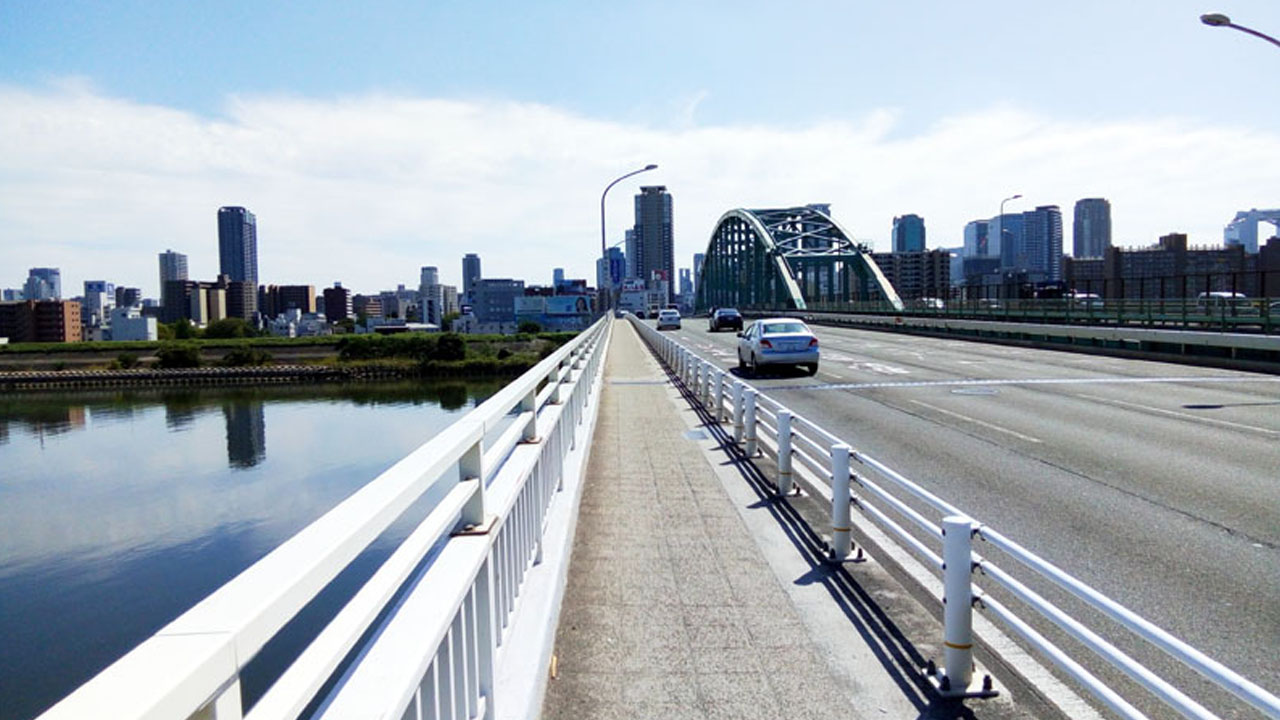
Crossing downstream via Jusan-Ohashi Bridge into the city center brings three challenges in quick succession: Chatancho's congestion, the crowds at Yodobashi Camera Umeda, and JR Osaka Station's complex route network.
The Real "Osaka" Begins South of Yodo River
Yodogawa Ward, Nishi-Yodogawa Ward, Higashi-Yodogawa Ward, and the Sanyo Shinkansen corridor lack tourist attractions entirely.
The authentic Osaka experience begins south of the Yodo River. Continuing south from the riverside, you'll hit Tenjinbashi-suji Shopping Street—a super-long 2.6km (1.6 miles) shopping arcade brimming with traditional "shitamachi" (downtown) atmosphere.
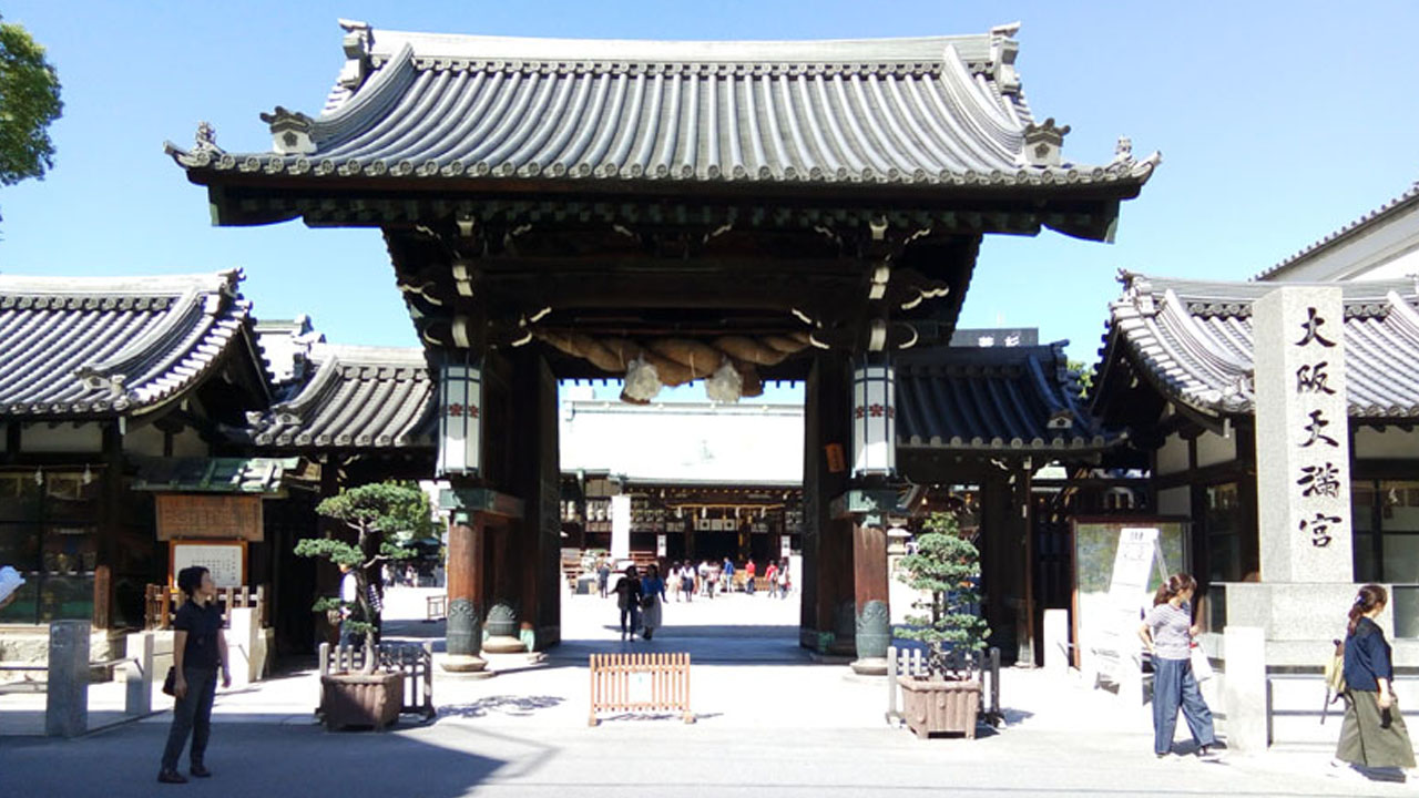
Osaka Tenmangu Shrine
At the southern end of the shopping street stands Osaka Tenmangu Shrine. Students pray here before exams; working professionals visit before certification tests.
Osaka Castle Park: First Major Highlight
Cross the Okawa Bridge and turn left to reach the first major highlight of this route.
Osaka Castle Park Overview
🏯 Osaka Castle Highlights
- Status: Top-tier tourist attraction & citizen recreation area
- Moat crossings: One north, one south (outer to inner moat)
- Amenities: Food stalls, benches, restrooms at the castle plaza
- New addition: JO-TERRACE OSAKA café & dining area beside Osaka Castle Hall
Yes, this is Osaka Castle's main keep (Tenshu).
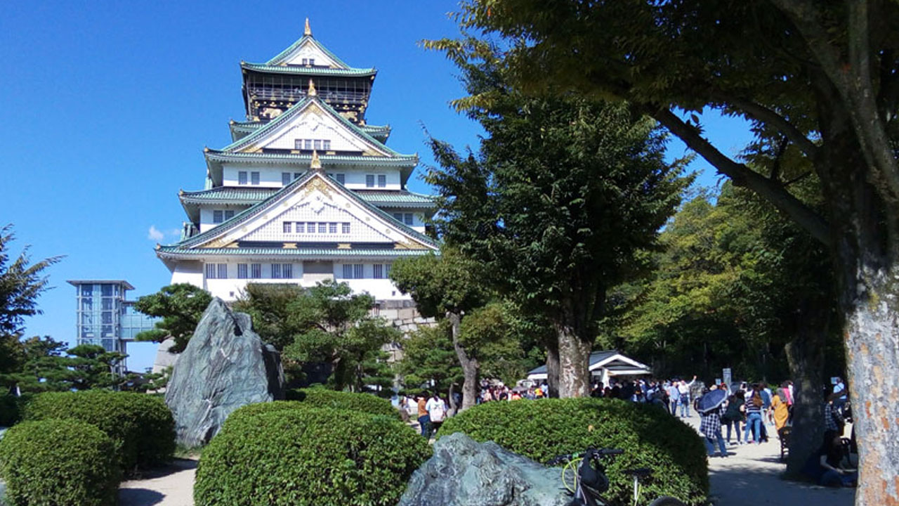
The castle plaza features food stalls, benches, and restrooms. Additionally, a stylish café and dining area called JO-TERRACE OSAKA has opened beside Osaka Castle Hall.
The Minami District: Dotonbori & Nihonbashi
Ride further south. Tsuruhashi and Ikuno Korea Town are restaurant and bar districts.
Heading straight south from Osaka Castle Park brings you to Abeno no Kaiwai—a mixed area combining mall culture with traditional shitamachi vibes.
The charm of a tram lazily passing beside a massive mall is unique, but it can't quite compete with neighboring Minami's energy.
Dotonbori: The Glico Sign
Rather than going all the way to Abeno, turn right earlier and head to see this:
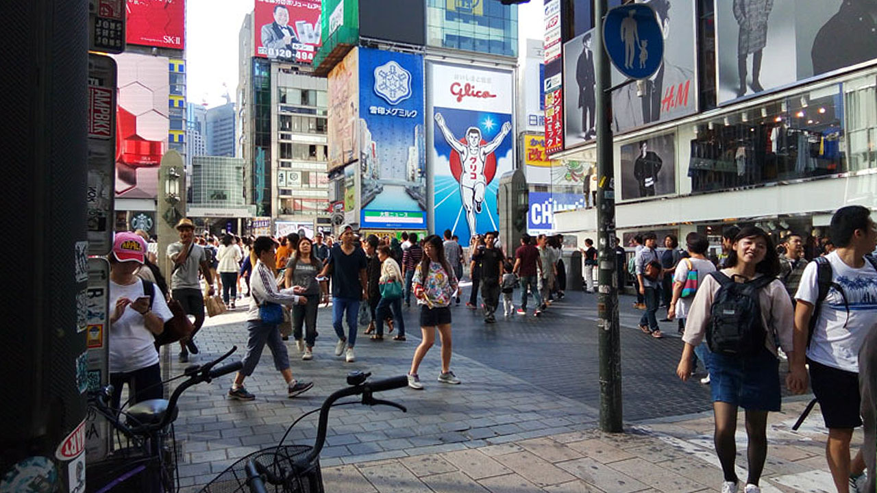
Yes, the Glico sign. Right now.
Nihonbashi: Otaku Paradise
Escape the crowds and head to Osaka's Otaku Paradise: Nihonbashi Otaroad.
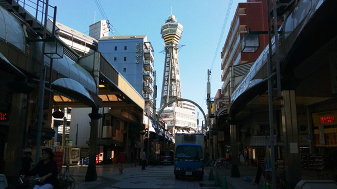
Shinsekai: Kushikatsu Heaven
The southern end of Nihonbashi is the entrance to Shinsekai. The entire area treats kushikatsu (deep-fried skewers) as sacred, offering it in grand fashion. The landmark is Tsutenkaku Tower.
Tempozan Ferry to USJ & Maishima
The Abeno, Tennoji, and Shinsekai area isn't Osaka's southernmost point. Nagai Stadium and Suminoe Kyo-Tei (boat racing) mark the true city limits.
Sakai City borders Suminoe Ward to the south—home to ancient kofun burial mounds, Yosano Akiko's birthplace, and Shimano headquarters.
The Harbor District
Heading west from Aizuru in Naniwa Ward brings you to the harbor district. Konohana Ward and Minato Ward along the bay lack walking charm—mostly residential and industrial zones with landmarks limited to the Dome and ORC200.
Taking Route 172 from Bentencho, ride all the way to the ocean's edge. The terminus is Osaka Aquarium Kaiyukan and the giant Ferris wheel at Osaka Port.
Tempozan: Japan's Second-Lowest Mountain
But my target is a mountain—a hill climb challenge. The mountain I'm tackling is Tempozan, a super B-class peak ranking as Japan's second-lowest mountain at just 4.5m (14.8 ft).
Steel yourself. Standing at the starting point. Ready, set—GOAL!
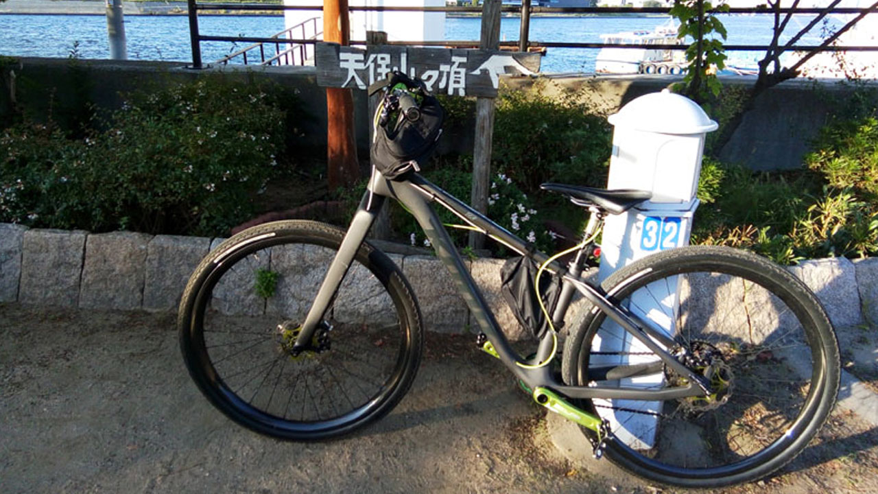
⛰️ Tempozan "Hill Climb" Stats
- Distance: 20m (65.6 ft)
- Elevation Gain: 4.5m (14.8 ft)
- Time: 5 seconds
Tempozan on Osaka's western edge is this lukewarm paradise, but the opposite eastern end features Kurai-Toge—a hellish climb averaging 20% gradient.
The Free Municipal Ferry
Behind Tempozan summit departs a municipal ferry.
Several of these free municipal ferries operate in Osaka's intricate harbor area. Godship!
Waiting in line: foreigners, local moms, one cyclist pair—that's the crowd. Across on Sakurajima sits USJ—these are foreign staff commuting.
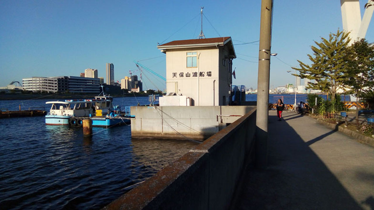
The crossing takes about 5 minutes. My first ferry ride since the Genova Line during Awaichi. Hmm, small boat motion affects my inner ear—20 minutes is my limit.
Maishima: Cycling Paradise
Maishima is a reclaimed land development. Wide roads, few traffic lights, no pedestrians—a high-speed circuit contrasting with Osaka Castle and Namba's bustle.
🚴 Maishima Cycling Highlights
- Road conditions: Wide, smooth asphalt
- Traffic: Minimal—mostly empty
- Events: Regular professional races (Maishima Critérium, Maishima Time Trial)
- Vibe: Urban cycling paradise
Emerging onto the riverside promenade. If you exit toward the road side instead of entering this pedestrian-side shortcut, you won't be able to reach the embankment for a while.
Final stretch: Sea breeze tailwind from the west + straight non-stop = perfect TT mode. A fierce 2km sprint course to that massive high-rise ahead.
Heading Home
North via Denpo-Ohashi Bridge, passing through Nishi-Yodogawa Ward—Osaka's northwest corner. Beyond lies Hyogo Prefecture's Amagasaki City.
5:36 PM—completely dark. About 5 hours to cover the major spots. The ferry timing was perfect too.
And that's an Osaka person's cycling tour of Osaka city, by an Osaka person!
Route Summary
🗺️ Route Overview
- Total Time: ~5 hours (12:30 PM - 5:36 PM)
- Difficulty: Easy to moderate
- Best for: Urban exploration, sightseeing
✨ Must-See Highlights
- Tenjinbashi-suji Shopping Street (2.6km)
- Osaka Castle Park & Tenshu
- Dotonbori Glico Sign
- Nihonbashi Otaroad
- Free Tempozan Ferry to Sakurajima
- Maishima cycling circuit
Quick Reference Table
| Start Point | Shin-Midosuji (near Sakaisaka River) |
| Key Crossing | Yodo River via Jusan-Ohashi Bridge |
| Ferry Route | Tempozan → Sakurajima (FREE, 5 min) |
| Bridge to Maishima | Konohana-Ohashi (spiral ramp available) |
| Return Route | Tokushichi-Ohashi → Yodo River embankment |
Distance & Elevation Notes
- Tempozan "Hill Climb": 20m (65.6 ft) distance, 4.5m (14.8 ft) elevation gain
- Tenjinbashi-suji Shopping Street: 2.6km (1.6 miles)
- Total Route: Approximately 30-40km depending on detours
Frequently Asked Questions
What is the best starting point for Osaka city cycling?
Shin-Midosuji near Sakaisaka River offers easy access from northern suburbs and connects to the Naniwa Bicycle Path along the river.
How long does a complete Osaka city cycling tour take?
Approximately 5 hours to cover major highlights including Osaka Castle, Dotonbori, USJ ferry, and Maishima.
Is the Tempozan Ferry free?
Yes! The municipal ferry from Tempozan to Sakurajima is completely free and takes about 5 minutes.
What are the must-see cycling spots in Osaka?
Osaka Castle Park, Dotonbori Glico sign, Tenjinbashi-suji Shopping Street (2.6km), Nihonbashi Otaroad, and the Tempozan Ferry to Sakurajima.
Is Maishima good for cycling?
Excellent! Wide roads, few traffic lights, and minimal pedestrians make it like a high-speed circuit. Professional races are held here regularly.
What's the difference between Kurai-Toge and Tempozan?
Tempozan is Japan's second-lowest mountain at 4.5m (14.8 ft)—a joke hill climb. Kurai-Toge on Osaka's eastern end averages 20% gradient—a serious challenge.