Kyoto Cycling Guide: Routes, Restrictions & Hill Climbs
Kyoto is Japan's premier tourist destination. The city center is a parade of shrines, temples, important cultural properties, national treasures, and World Heritage sites.
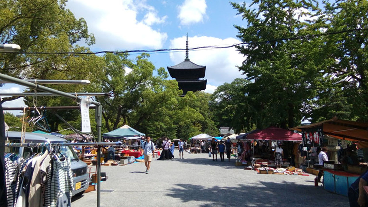
Just 1km from JR Kyoto Station stands To-ji Temple's iconic five-story pagoda—one of the closest World Heritage sites to any train station in Japan. Every first Sunday brings the To-ji Garakuta Market (antiques), and on the 21st, the Kōbō Market opens.
Let's explore cycling in this ancient capital from an Osaka cyclist's objective perspective.
Cycling Situation in Kyoto
Kyoto's southern edge borders the northern end of the Hanshin area, adjacent to three major rivers: Katsura, Uji, and Kizu. This provides easy access to two major long-distance routes:
- Yodogawa Cycling Road—connecting to Osaka Bay
- Yawata-Kizu Bicycle Path
Just two JR stations from Kyoto Station lies Otsu Station in Shiga Prefecture. Lake Biwa—the destination of the famous "Biwaichi" loop ride—is right on your doorstep.
Kyoto sits in a basin surrounded by mountains and hills. The northern suburbs feature renowned hill climb spots, while Mount Hiei is a mountain biking destination.
Seika Town on the Nara border hosts Tour de Japan stages. Katsura River Green Space along the riverbank hosts the final round of Kansai cyclo-cross.
To the north lie Maizuru, Amanohashidate (one of Japan's Three Scenic Views), and Tango Peninsula on the Sea of Japan coast. Iga's boat houses are particularly famous.
Bicycle Restrictions: The Reality
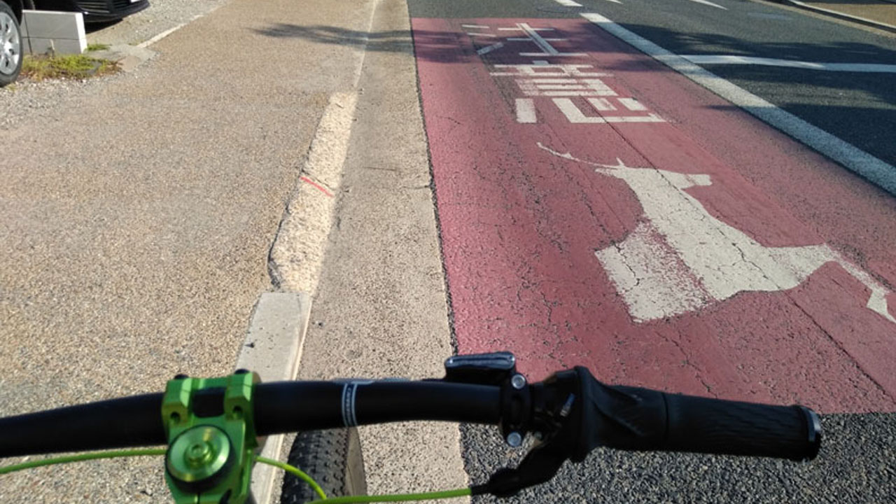
⚠️ Personal Bikes Not Welcome: Kyoto's center is unique. Every area is a tourist destination—landmarks appear as frequently as convenience stores. Neither personal cars nor bicycles are particularly welcome in the core tourist zones.
This manifests through strict illegal parking enforcement and bicycle prohibition zones around Kawaramachi.
Kyoto's Bicycle Prohibition Zones
The following map shows light vehicle (bicycle) prohibited areas around Kawaramachi:
The green lines marking prohibited zones—Karasuma to Yasaka Shrine, and City Hall to Takatsuji—are particularly frustrating. These aren't covered arcades; they're two-to-five-lane major roads.
Rare Restriction: Cars and motorcycles pass freely. Only light vehicles (bicycles) are prohibited—unusual even internationally.
This makes leisurely sightseeing rides nerve-wracking for rule-following cyclists. Parking lots are often far from destinations, and gardens are enormous.
Locals and neighboring prefecture residents have already explored most spots thoroughly. This guide focuses on routes where local cyclists enjoy riding—tourists from afar may find different priorities.
Yodogawa Cycling Road
Three major rivers converge at Kyoto's southern edge: Katsura, Uji, and Kizu. They merge into the Yodo River, cutting through the Keihanshin area before emptying into Osaka Bay.
The cycling path along Katsura River forms the latter half of Osaka's Yodogawa Cycling Road. The Kyoto section is officially called the Kizu-Yahata Bicycle Path.
Route Details
- Start: Togetsukyo Bridge, Arashiyama (Kyoto)
- End: Kema Park (Osaka)
- Distance: ~50km one-way / 31 miles
The path from Arashiyama to Sewaritei (where three rivers merge) is somewhat narrow—watch for passing and oncoming traffic.
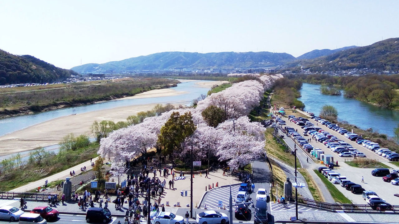
Sewaritei: Midpoint & Cherry Blossoms
Sewaritei sits midway between Arashiyama and Kema. During cherry blossom season, the view is spectacular.
Turning here creates a manageable 50km (31 miles) round trip—ideal for beginners, cross bikes, mini-velos, or road bike debuts.
Facilities: Toilets, vending machines, BBQ area, and Sakura Deai Kan (cherry blossom meeting hall) are all on-site. Weekends draw crowds of Keihan cyclists.
Beyond Miyukibashi Bridge
South of Miyukibashi, Katsura becomes the Yodo River. The cycling path widens dramatically—almost a high-speed circuit to Kansai Medical University Hospital.
After that, bollards (car stops) appear frequently toward Kema—15-20 per 20km stretch.
Verdict: Distance, surface quality, and facilities are all excellent. Arashiyama to Kema is perfect for a first 100km (62 miles) long ride in the Keihan area.
From here, the Kita-Osaka Cycle Line connects to Osaka City Hall, the Stock Exchange, and Central Public Hall. Highlights include Gokan sweets shop in Kitahama, the fifth-generation president statue at the exchange, and Nakajima Rose Garden (May).
One Challenge: Headwinds from the west. Kyoto to Osaka is mostly against the wind; return is with it.
Kamo River Path
The Kamo River promenade offers classic Kyoto scenery. You can ride along both the right and left banks.
Route Details
- Distance: 6-7km / 3.7-4.3 miles max
- Surface: Mostly dirt, partially paved
- Type: Pedestrian promenade (not bike lane)
The start is near Kami-Gamo or Imperial Palace Park. The scenery is peaceful.
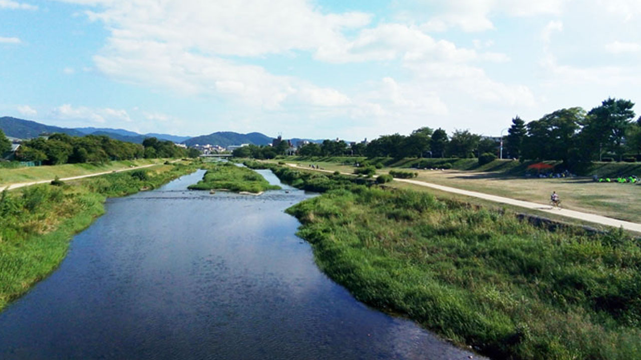
Shared Space: This is a pedestrian path, not a bike lane. Expect walkers, joggers, families, and especially couples—it's THE date spot in Kyoto.
The left bank appears slightly less popular but is also dirt—be cautious after rain.
Terminus Points
- Right bank: Ends near Kiyomizu-Gojo. The final few hundred meters are bumpy—use stairs before the bridge to reach the road.
- Left bank: Continues south of the Shinkansen tracks, but narrows and loses its Kyoto charm. Best to join the road at Gojo.
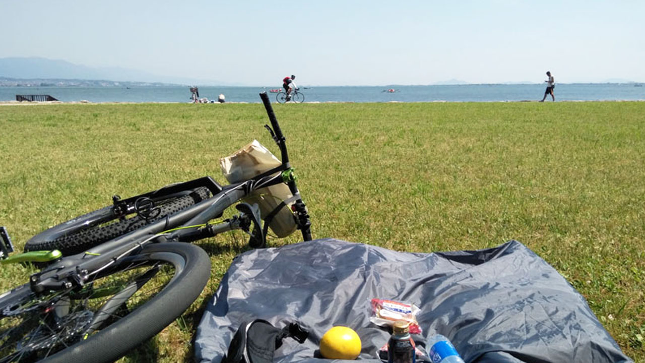
Lake Biwa Connection
Kyoto to Otsu is a quick ride. Only one intermediate station on the Tokaido Line: JR Yamashina. Distance: roughly 12km (7.5 miles).
Avoid Kyoto Station's chaos—start from Gojo as mentioned earlier. Goal: Lakeside Park beside Lake Biwa Hotel.
Route 1: The Shortest (But Dangerous)
The orange Route 1 path is shortest. Two passes—Kyoto to Yamashina, then Yamashina to Otsu—are the real challenges.
Road Conditions Critical: The main road is dangerous. Thread through narrow side roads and sidewalks. Meishin Expressway side roads are relatively calm.
The tunnel area near Kyoto-Yamashina is the first hurdle for beginners. Yamashina town center offers brief rest. Otsu's Oiwake to Otani is the second—steep grades and narrow roads test your resolve.
Safer Alternative: Uji River Route
Other options include the Seto route via Uji River, Route 30, or mid-point crossings. The Uji River is safest but doubles your distance.
Starting from the three-river confluence avoids the complicated Nakashima waterway maze. From there, the left bank (south side) route from Kangetsu Bridge is straightforward.
For Biwaichi Loops: If you plan a self-supported Biwaichi from Kyoto/Osaka and casually take Route 1 clockwise, you'll face trucks and buses from morning until noon. The impression becomes "too many cars, aggressive left-side passing"—a shame for a long ride.
The Uji River route isn't a major artery to Hokuriku, so large vehicle traffic is milder. Highlights include Byodoin Phoenix Hall and Tenkase Dam.
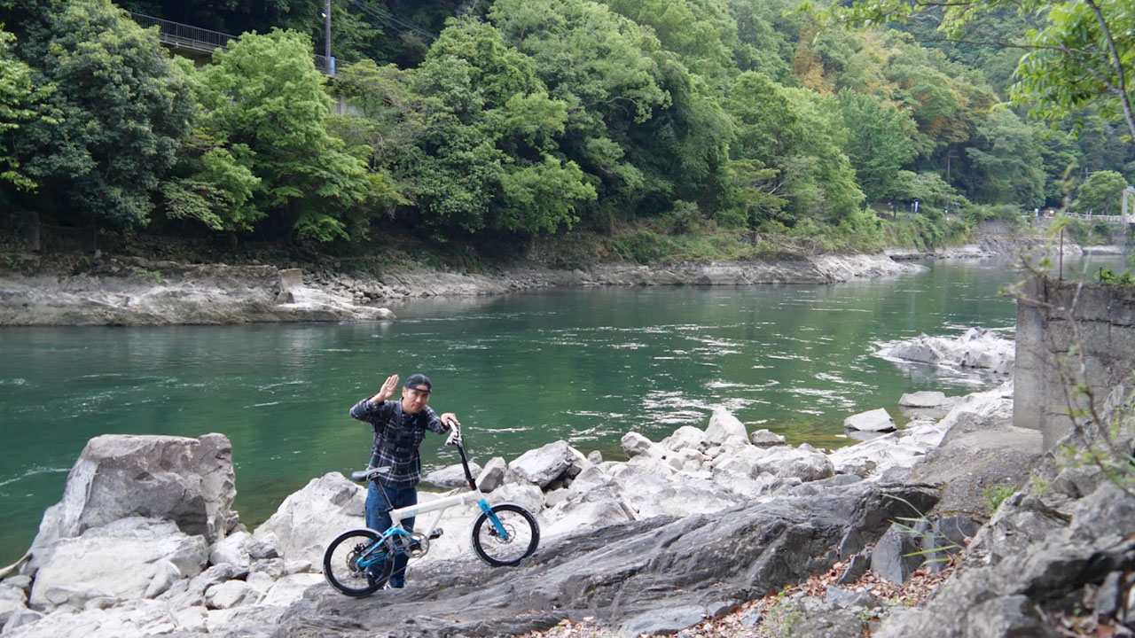
For tea and matcha cuisine, turn left into the approach road. Ice cream, soba, ramen—all green.
A forest-road path between mountain and river leads to Tenkase Dam and a suspension bridge.
Kyomizaka Hill Climb
Kyoto's top urban hill climb rivals Minoo's Shōoji-ji (Northern Osaka #1) and Takarazuka's Sakuragaoka (Rokko Mountains #1).
The course lies north of the World Heritage Kinkaku-ji (Golden Pavilion).
Climb Statistics
- Distance: 3km / 1.9 miles
- Elevation Gain: 200m / 656ft
- Difficulty: Beginner-friendly easy course
Ideal for road bike debuts, hill climb introductions, regular training, or Strava segments.
Start Point: Kōetsu Chaya Tea House
The landmark is Kōetsu Chaya tea house. A short distance further brings you to the electronic TT start board for hill climbs. Dedicated riders continue from here to Miyama, Katata, Nose, or even the Sea of Japan.
For Beginners: Turn back quietly and take photos at the photogenic Chikuzaka slope beside the start point—perfect for Instagram.
Finish & Beyond
Seriously completing Kyomizaka brings you to Himuro intersection. Pushing further reaches Hasegawa—a handmade log cabin restaurant famous for hamburgers and omurice.
Return the same way, or descend to Sugisaka and loop back via Route 162 toward Utsunomiya.
Semi-Off-Road Nagasakadō
Kyomizaka is the main road. The back route is the ancient Nagasakadō—old path, long slope. It tickles certain cyclists' hearts perfectly.
The Name Delivers: Amazingly noisy pavement—semi-off-road! Branches crackle, stones crunch. Playfully rough ride ahead.
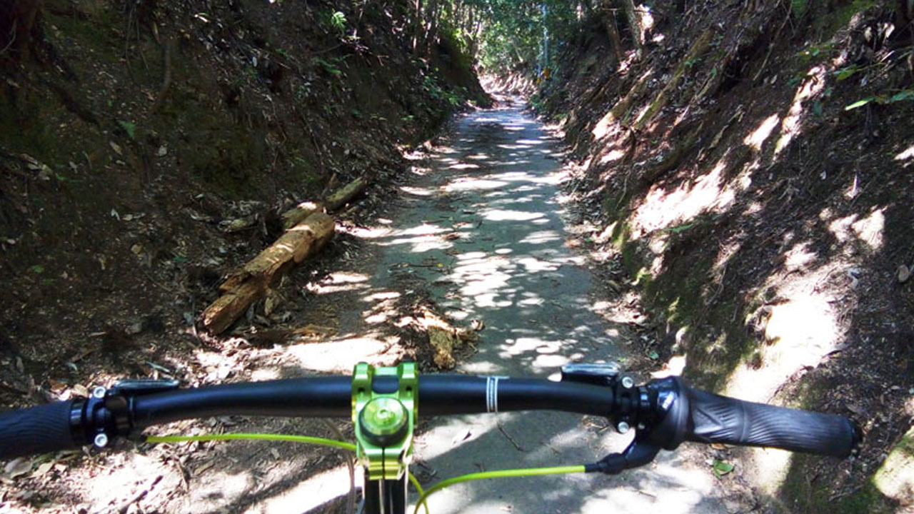
The surface is as described, and the route is more direct and severe than Kyomizaka. Easy for MTB, slightly hard for drop bars, perfect for all-road bikes.
Almost no pedestrians or vehicles, though occasional hikers appear. Views are nonexistent—not an interesting walking course.
Entering the Kyoto Trail hiking course beyond Hasegawa offers genuine panoramic city views.
Yahata-Kizu Bicycle Path
The 45km (28 miles) from Togetsukyo Bridge in Arashiyama to Izumi-Ohashi in Kizu is the Yahata-Kizu Bicycle Path. The section to Sewaritei overlaps with Yodogawa Cycling Road.
Sakura Deai Kan sits exactly midway between three cycling road starting points—use it freely.
Sewaritei to Kizu-Ohashi
Bicycle-Pedestrian Exclusive: Few bollards, clean surface. 20km+ (12+ miles) no-stop rides possible. White lines on both road edges are your guide—follow them and you won't get lost.
Kizu-Ohashi and Kizu City have little to see—a typical quiet town. The station area has decent bread and ramen (Ramenlog rating 3.5+).
The floating bridge that washes away in floods is near the start—I completely missed it on my cycling day. On sunny days without flooding, it's just an ordinary old bridge.
Connection to Nara
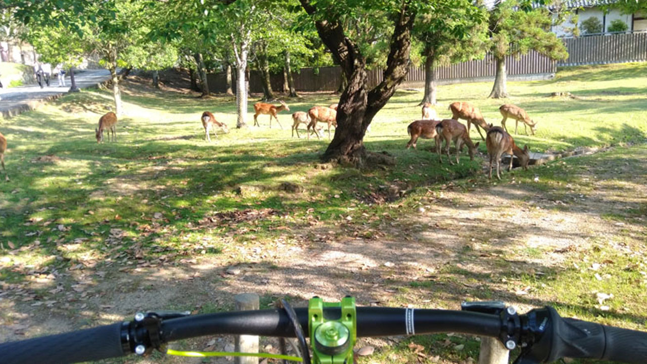
Kizu City borders northern Nara City. Heading slightly south reaches Nara Park—Tōdai-ji Temple and Kasuga Taisha.
Other routes to Nara all involve mountain passes. The Kizu River path is the clearest and most comfortable among surrounding river cycling courses.
Nara Deer: They swarm Nara Park, all focused on grass, ignoring you. Too human-tamed? Minoo's deer are more nervous.
Kyoto City Tour Route
All-day bicycle prohibition zones concentrate around Kawaramachi and City Hall. Avoid them and loop around.
Pilgrimage Model Course
Kinkaku-ji, Imperial Palace, Fushimi Inari, To-ji, and Nintendo Headquarters (yes, the video game company)—a pilgrimage route of about 25km (15.5 miles).
Parking Available: Except Mario Shrine, parking lots exist everywhere. Only Kinkaku-ji charges admission; Fushimi Inari, Imperial Palace, and To-ji are free.
Add Kyoto Tenmangu Shrine, Nijo Castle, Gokin Shrine, Yasaka Shrine, Kiyomizu-dera, etc.—history buffs will find it a theme park.
Quick Reference: Route Summary
🚴 Recommended Routes
- Yodogawa Cycling Road: 50km one-way, beginner-friendly long ride
- Kamo River Path: 6-7km scenic urban ride (shared path)
- Lake Biwa via Uji River: Safe but longer (~30km vs ~15km Route 1)
- Kyomizaka Hill Climb: 3km, 200m gain—perfect training climb
⚠️ Key Warnings
- Kawaramachi & City Hall: No-bike zones on major roads
- Lake Biwa Route 1: Heavy truck traffic, dangerous
- Kamo River: Shared pedestrian path—yield to walkers
This concludes the Kyoto city cycling course guide.
Frequently Asked Questions
Can I ride my own bicycle in central Kyoto?
Personal bicycles face restrictions in central Kyoto. Kawaramachi and areas around City Hall have strict no-bike zones on major roads—unusual even internationally. Cars and motorcycles are allowed, but light vehicles (bicycles) are prohibited. Parking enforcement is also strict.
What's the best cycling route from Kyoto?
The Yodogawa Cycling Road (Kyoto section: Kizu-Yahata Bicycle Path) is ideal. Starting at Togetsukyo Bridge in Arashiyama, it runs 50km one-way to Kema Park in Osaka—perfect for a first 100km long ride.
How do I get from Kyoto to Lake Biwa by bike?
Two main options: (1) Route 1 via Yamashina—shortest but dangerous with heavy traffic and narrow roads. (2) Uji River route via Seto—safer, scenic, but doubles the distance (~30km vs ~15km). For Biwaichi loops, take the Uji River to avoid trucks.
What's a good beginner hill climb in Kyoto?
Kyomizaka Pass is Kyoto's top urban hill climb. 3km (1.9 miles) with 200m (656ft) elevation gain—perfect for road bike beginners or Strava training. Start near Kōetsu Chaya tea house, finish at Himuro intersection.
Is the Kamo River path good for cycling?
The Kamo River promenade offers classic Kyoto scenery but is a shared pedestrian path, not a bike lane. Expect walkers, joggers, families, and couples—it's a popular date spot. 6-7km (3.7-4.3 miles) of mostly dirt/gravel with some pavement.
Where can I find bike shops in Kyoto?
Kyoto has several specialty shops: Wise Road Kyoto, Sylvester Kyoto, LORO (recumbent bikes), and Kyubee. The cycling infrastructure is well-developed despite tourist restrictions.