Kuragari Touge (Route 308): Cycling Japan's Steepest National Highway
To someone like me who lives in the northern part of Osaka, the neighboring cities of Kyoto and Kobe feel like my backyard. I can hop on the Hankyu express train and be there in a flash.
In stark contrast, the regions of Nara and Wakayama to the south and east feel like foreign lands. I have absolutely zero sense of direction there.
Even after I started traveling long distances by bicycle, I found myself constantly heading towards Kyoto or Kobe, actively avoiding Nara and Wakayama. Navigating the chaotic, traffic-heavy center of Osaka City to get south was just too much hassle.
However, today is different. I finally decided to challenge my very first Osaka-to-Nara cycling trip. My chosen route? The legendary National Route 308.
Kuragari Touge (Dark Pass) Profile
Before we begin the journey, let's look at the terrifying statistics of the mountain pass blocking the route to Nara.
| Stat | Details |
|---|---|
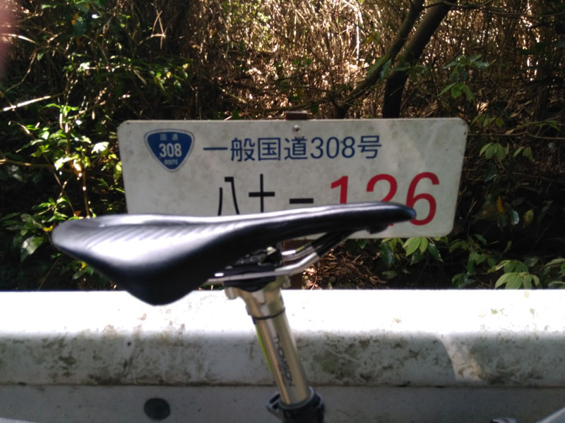
| Route Name | National Route 308 (國道308号) |
| Location | Border of Higashiosaka City (Osaka) and Ikoma City (Nara) |
| Elevation | Approx. 455 meters (1,492 ft) |
| Max Gradient | Approx. 37% (At the infamous Osaka-side hairpin) |
| Pavement Type | Concrete with slip-proof ring grooves, and historical cobblestones at the summit. |
| Danger Level | Extreme. Widely considered Japan's steepest and most dangerous national highway. |
Approaching the Foothills of Mount Ikoma
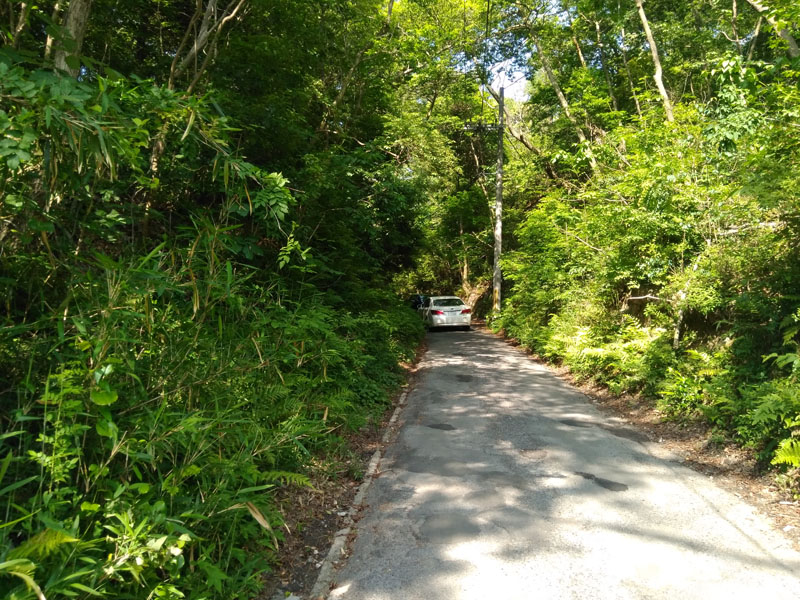
After passing the Hanazono area—famous nationwide for its rugby stadium—I finally arrive at the foothills of the Ikoma mountain range. This is where Route 308 starts showing its true colors.
Right after crossing the railway tracks, the initial section is just a gentle slope. It feels almost anti-climactic. But that comfort lasts a maximum of 3 minutes. From the very beginning, a serious incline hits you like a wall.
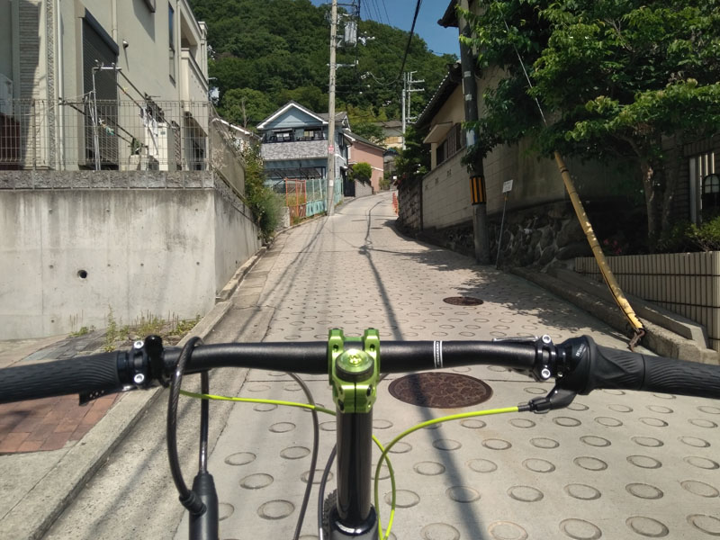
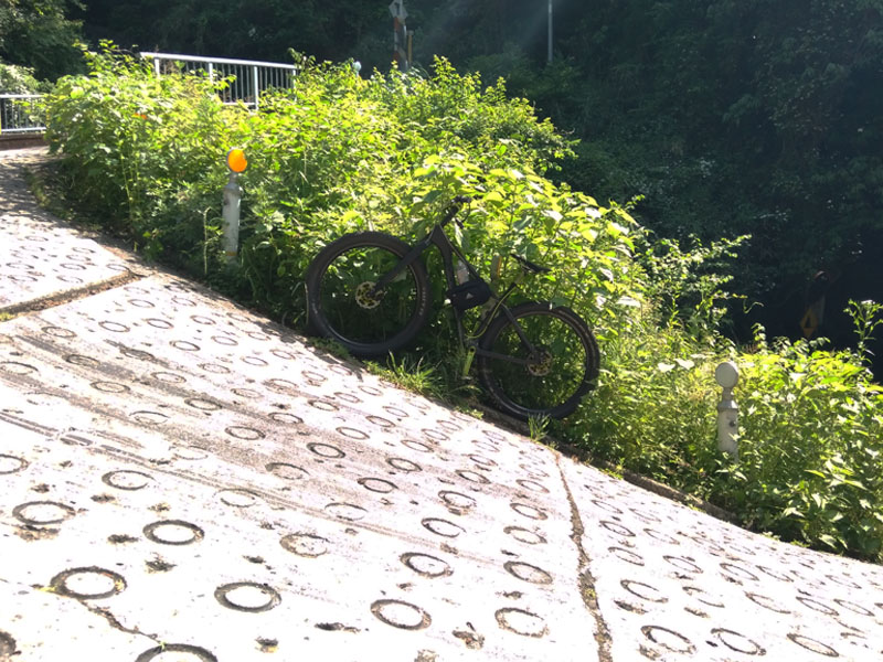
We are still in a residential area, but the road surface has already transitioned to concrete paved with round, anti-slip ring treads. This jarring, ring-patterned concrete is the default state of "Cruel Highway" 308.
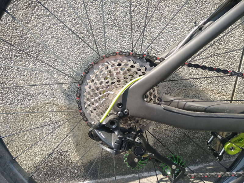
Instantly, my legs scream at their limits. A half-hearted gear ratio will leave you standing still. I have zero choice but to deploy the massive 11-speed 42T granny gear!
The Trenches of Route 308
As human settlements fade and the feeling of the deep mountains intensifies, terrifying beasts begin to bare their fangs. Bears? No, massive drainage trenches.
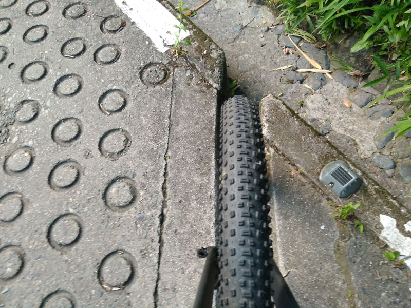
These iron-grate trenches regularly slice across the road surface. Skinny tires on road or cross bikes are absolute prey to these gaps, highly susceptible to pinch flats (snake-bites).
The incline only gets steeper; it never, ever gets gentler. It is a continuous, agonizing climb. My chest tightens rapidly, and sweat pours down my face in buckets.
"If I can't climb this even in 11th gear, I have no choice but to walk!"
And just like that, my glorious hill climb prematurely ended. I switched to hiking mode and trudged up the mountain. Instances like this are exactly why flat pedals and sneakers are vastly superior to clip-in cycling shoes for this route.
The Peak of Darkness: The Greatest Hill in Japan
The absolute highlight—or rather, the deepest darkness—of Route 308 is Kuragari Touge. The name literally translates to "Dark Pass." It is incredibly fitting.
Yes, believe it or not, this goat path is an official National Highway, beloved by road maniacs across the country.
The Devil's 37-Degree Hairpin
Finally, we arrive at the main event. It is the infamous hairpin curve. Every cyclist who stands here finds their vision clouded by the dark despair of the incline.
This picture captures the approximate real-world angle. To be perfectly honest, attempting to ride the inner apex of this curve is physically impossible on a bicycle. The outer rim of the curve is the only marginally viable path.
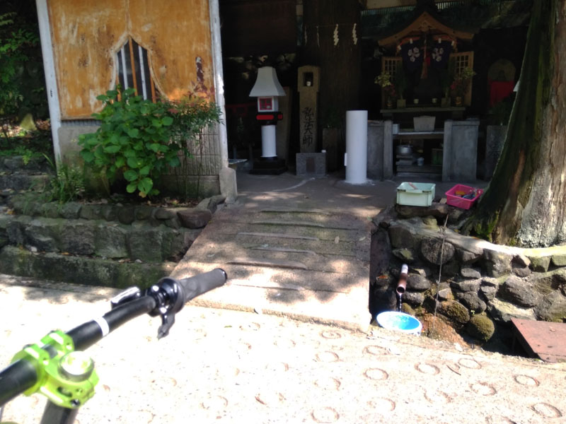
A Moment of Peace at Kobo Daishi's Shrine
Just when you feel like you might collapse, a small shrine dedicated to Kobo Daishi (a famous Buddhist monk) appears, complete with natural spring water. The absolute peak of the road's steepness ends here.
While the worst is over, the concrete slopes continue relentlessly. The "normal mode" of Kuragari Touge would easily be considered the peak difficulty of any other mountain pass.
The Goal: The Historic Cobblestones
Oh, I see the pass's teahouse! The goal!
But suddenly, my bike is met with a brutally violent cobblestone road. My tires are bouncing incessantly. Wait, am I riding in Paris-Roubaix? No, this is Osaka-Nara.
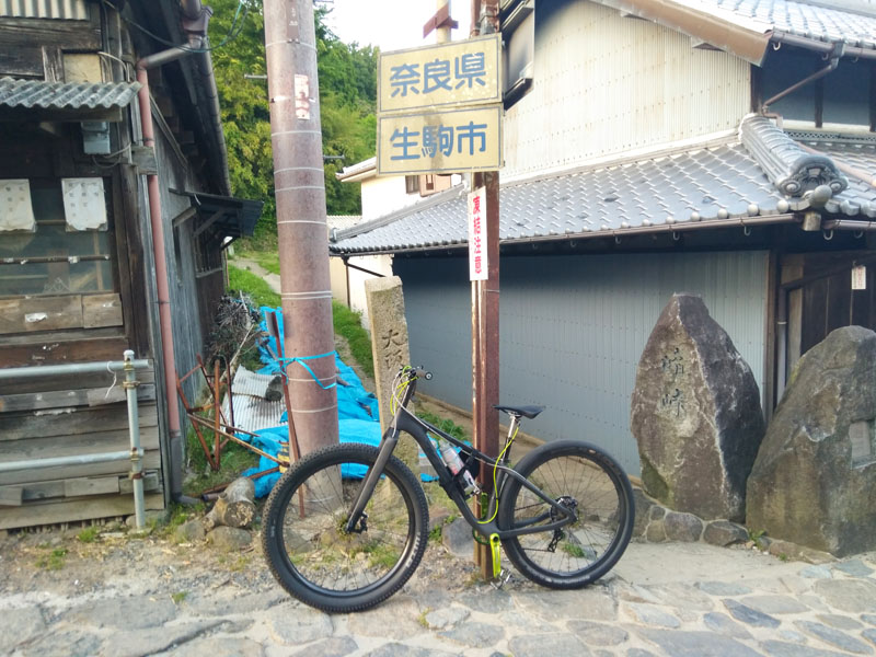
The space right in front of the teahouse marks the exact border. The cobblestones at this pass have a profound history. In the early Edo period, feudal lords used this path for their mandatory journeys to the capital (Sankin-kotai), and later, it was a major pilgrimage route to the grand shrines of Ise.
The Harrowing Downhills & The Deer of Nara
From the teahouse onwards, Nara Prefecture officially begins. The road towards South Ikoma is entirely downhill. The path widens, and the views open up beautifully.
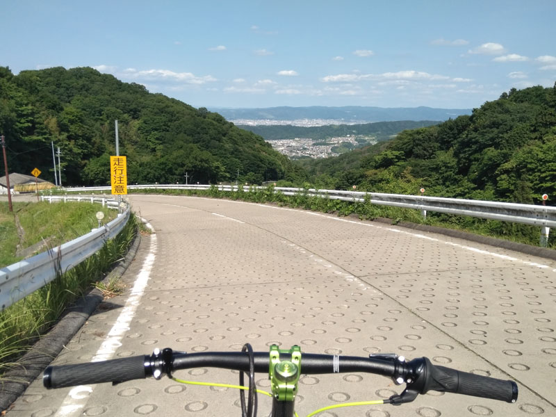
However, the gradient is terrifyingly steep. Descending this on a road bike with standard caliper brakes is a death wish. My off-road hydraulic disc brakes felt like the bare minimum requirement to stop safely.
The reality of Route 308 is this: The uphill is brutally hard, and the downhill is highly dangerous. Both directions are an extreme test of toughness. If you just want to get to Nara safely while exploring Osaka, taking National Route 25 through Kashiwara is the logical method.
Oncoming Traffic and Muronoki Pass
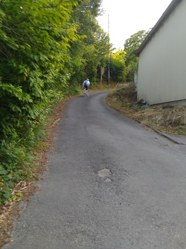
Even descending into the valley towns of Nara, the ordeal isn't over. Route 308 eventually climbs back out of the city limits towards the mountains. And remember, this is a National Highway. Standard sedans will actively drive towards you on this single-lane path.
Before leaving the Ikoma mountains, you have to conquer Muronoki Touge. Compared to the massive Kuragari Touge, this is a "small" pass, but anywhere else, it would be considered a major challenge.
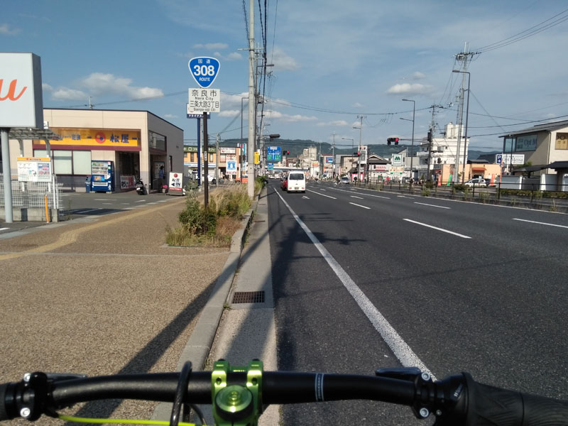
Arrival in Nara
Once the massive Second Hanna Toll Road comes into view, the sense of flat land finally becomes a reality. Upon entering central Nara City, Route 308 remembers its Buddha-like mercy and becomes deeply peaceful.
As you approach JR Nara Station, pedestrians and tourists flood the streets. And prominently displayed on the roads are these unique signs:
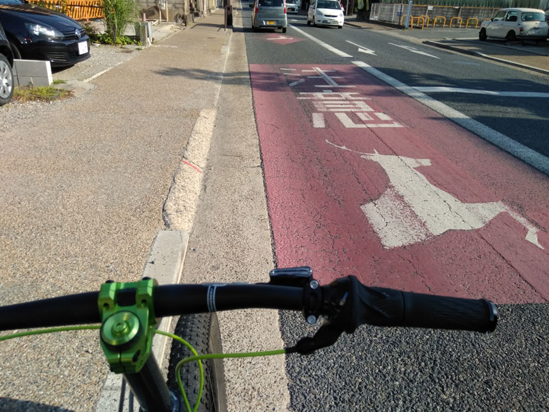
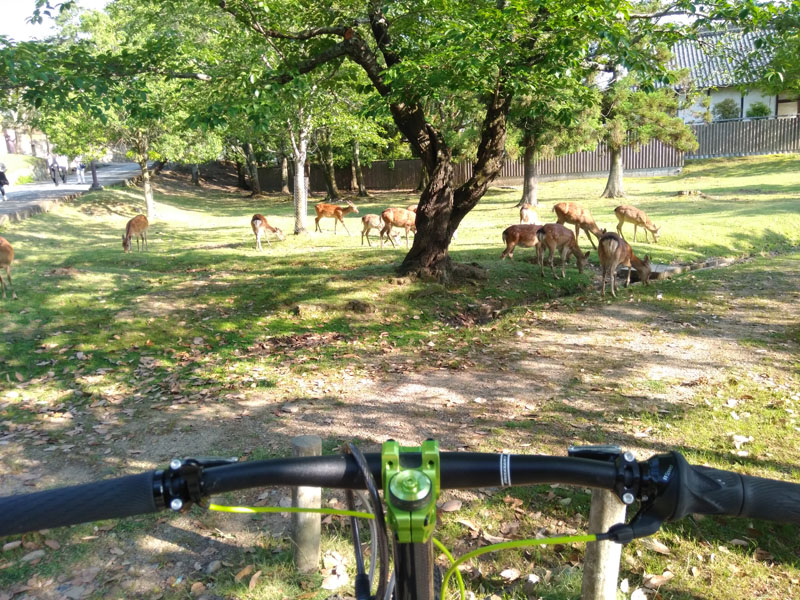
It's not just humans wandering around. The sacred deer of Nara Park roam the streets freely as if they own the place. They are considered messengers of the gods, and are protected as designated natural monuments.
The Return Trip: Descent into Darkness
The name "Kuragari" (Dark) comes from the fact that the pass gets dark very early in the day. Navigating it after sunset without powerful headlights is tantamount to entering a dungeon without a torch.
Descending the massive 37% hairpin towards Osaka requires a complete change in strategy. You must drop your seatpost to the absolute minimum, shift your hips completely off the back of the saddle, and feather the rear brake relentlessly. It closely mimics aggressive off-road mountain biking.
Kuragari Touge Breakdown
- Osaka Side Ascents: Complete Hell
- Nara Side Ascents: Mini-Hell
- Climbing: Agonizing
- Descending: Terrifying Mega-Hell
- Hazards: Beware of deep trenches, oncoming cars, and the cobblestones at the peak.
If you plan to visit this legendary slope out of curiosity, be highly alert of pinch punctures on the descent, and respect the mountain's steepness.