Osaka-Tokyo Cannonball: 3-Day Budget Cycling Guide

Last autumn, I completed a new build—a flat-bar road bike designed for casual cycling and touring. At just ¥50,000 total (¥3,000 frame + ¥30,000 wheels), it delivers mid-range endurance performance perfect for long-distance rides.
In December 2022, I used this bike to complete a leisurely 500+ km journey from Osaka to Tokyo over three days. Here's the full account—routes, costs, and lessons learned.
What is a "Cannonball"?
In cycling circles, completing the Osaka-Tokyo route (or vice versa) in under 24 hours is called a "Cannonball" challenge—named after the cannonball run automobile races of old.
Reality check: I'm nowhere near that level of insanity. Riding rural highways at night isn't exactly fun or safe.
So instead, I planned a normal 3-day, 2-night itinerary—roughly 170 km per day. Even this is considered extreme by most people, who'd say "just take the Shinkansen!" But that's not the point, is it?
Japan Cycling Loop Comparison
- Awaichi (Awaji Island): 150km / 93 miles
- Biwaichi (Lake Biwa): 250km / 155 miles
- Osaka-Tokyo Cannonball: ~540km / 336 miles
- Shikoku Loop: 1,000km / 621 miles
- Hokkaido Loop: 2,500km / 1,553 miles
Serious riders have optimized routes under 500 km.
Route Overview & Planning
🗺️ Route Details
- Main Route: National Route 1 (with shortcuts)
- Tokyo Start Point: Nihonbashi Bridge
- Osaka Start Point: Umeda Shindō Intersection
- Total Distance: ~530 km (optimized from standard 550 km)
- Elevation Gain: ~4,000 m
- Riders: Solo
⚠️ Key Challenges
- Iga Pass (Day 1) — mountain section between Kinki and Tokai regions
- Hakone Pass (Day 3) — toughest climb at Shizuoka-Kanagawa border
- Monotonous Day 2 (Nagoya-Shizuoka) — mental challenge
The classic Cannonball route follows National Route 1 or the Tokaido corridor. I incorporated several shortcuts to trim it down to about 530 km.
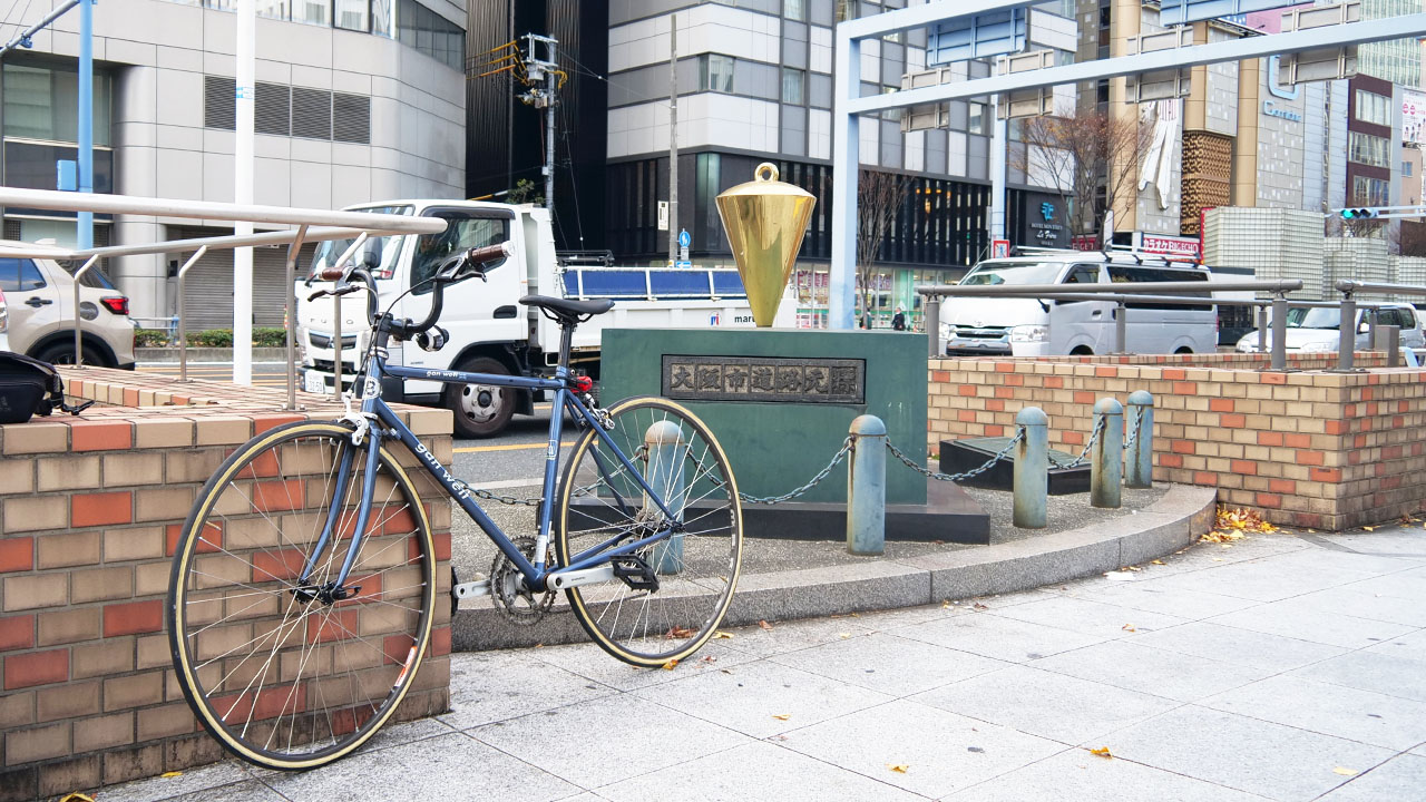
Note: My bike's stem faces backward—this is a special "city-bike style" setup. Also, yes, I wore jeans. Just a casual 500km walk, right?
Why Osaka → Tokyo (not reverse)?
Wind matters: Starting from Osaka means you generally get tailwinds from the west. Going Tokyo→Osaka often means headwinds all day—like my January 2021 Shimanami Kaido.
Also, summer and winter long-distance cycling isn't comfortable.
Budget & Accommodation
A formal Cannonball is a 24-hour single-push challenge. My version? budget.
💰 Budget Rules
- Accommodation limit: ¥5,000/night
- Food limit: ¥2,500/day
- Emergency backup: JR "Seishun 18 Ticket" (train pass) — ¥11,800 for unlimited regional train travel
The National Route 1 corridor runs parallel to the Tokaido Shinkansen and JR lines, making emergency exits easy—unlike my Hokkaido circumnavigation where escape routes were scarce.
My Actual Schedule
- Day 1: Osaka → Nagoya (170 km)
- Day 2: Nagoya → Shizuoka (178 km)
- Day 3: Shizuoka → Tokyo (172 km) — risky
I avoided weekends and rural areas after struggling to find lodging during a summer Hokkaido ride. Nobody wants to pay ¥10,000 for a basic business hotel single room again.
🏨 Hotels Used (prices at time of stay)
- Nagoya: Business Hotel Daikichi — ¥2,400
- Shizuoka: Shizuoka Park Hotel — ¥3,600
- Tokyo: Hotel Accela — ¥3,800
Total accommodation: ¥9,800 — cheaper than a one-way Shinkansen ticket!
Day 1: Osaka to Nagoya (170 km)
The first day of my relaxed Cannonball covered Osaka to Nagoya. This route is familiar from past Ise Shrine pilgrimages and Sekigahara crossing tours.
📊 Day 1 Statistics
- Distance: 170 km / 106 miles
- Elevation Gain: 1,300 m / 4,265 ft
- Key Challenge: Iga Pass climb
The Iga Mountain Section
The Iga region—bordering Kinki and Tokai—is the real mountain section. The road here is National Route 163 (not Route 1), with heavy truck traffic, narrow shoulders, and no sidewalks. Not ideal.
Route Comparison
The Iga-Ueno via Route 163 is the easiest option.
Simple route: Osaka Umeda → Shijonawate → Kizugawa → Kasagi → Iga-Ueno (hard) → Suzuka → Yokkaichi → Kuwana → Nagoya
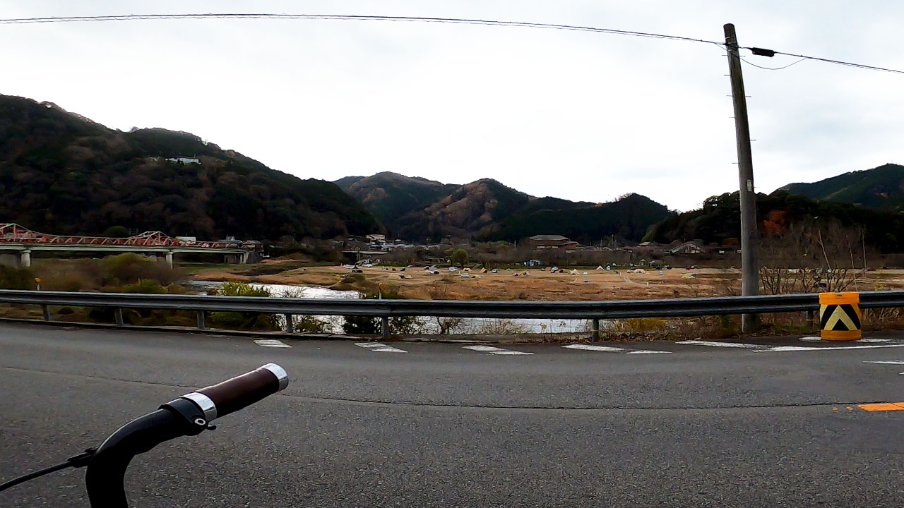
Day 2: Nagoya to Shizuoka (178 km)
This section was unfamiliar territory for me—no prior visits or local knowledge. The only comfort? Fewer climbs.
📊 Day 2 Statistics
- Distance: 178 km / 111 miles
- Elevation Gain: 912 m / 2,992 ft
- Weather: Sunny
- Temperature: 2–9.5°C (36–49°F)
- Wind: West, 3–5 m/s
- Key Issue: Frequent bicycle restrictions on Route 1
The Route is Simple... But Boring
The route is simple: National Route 1 all the way. No good detours exist. However, bicycle access restrictions appear frequently—especially between Nagoya and Okazaki. The scenery is also monotonous.
Entertainment during boring rides? Food. Shizuoka = Sawayaka = Hamburger Steak.
Sawayaka Hamburger Steak Pilgrimage
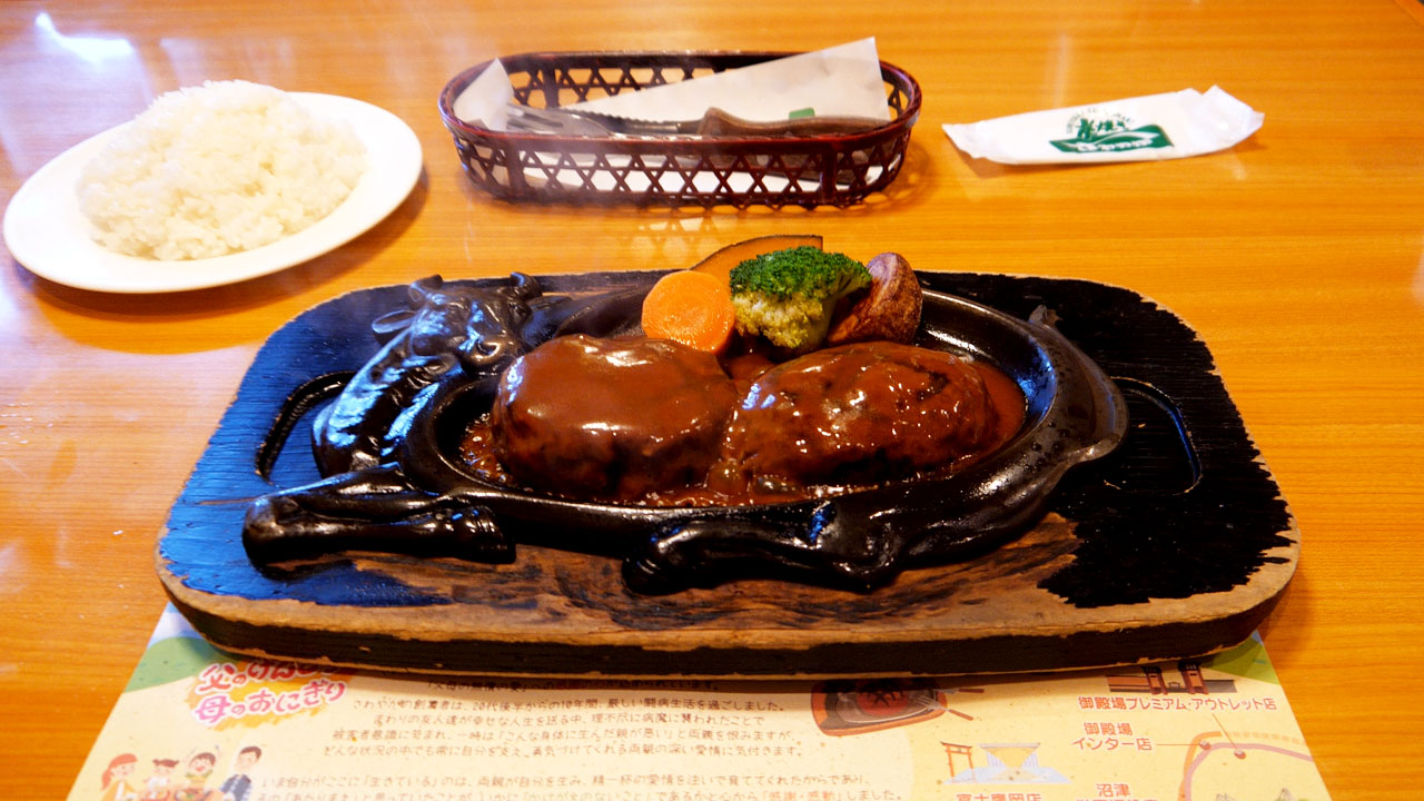
Sawayaka is extremely popular—lines run morning to night. I hopped between three locations near Hamamatsu:
- Sawayaka Hosoe Main Store — 14:00, 45-min wait (15 parties)
- Sawayaka Hamama Aradama — 14:30, 30-min wait (7 parties)
- Sawayaka Fukai Main Store — 16:00, no wait
A 30-minute wait at 2 PM is serious popularity—not your average family restaurant. I nearly became a "hamburger refugee." If you plan to visit Sawayaka, arrive early or bring patience. (Formal Cannonball riders can't afford such detours anyway.)
I arrived at Shizuoka Park Hotel around 8:30 PM, slightly delayed by the Sawayaka pilgrimage.
Route: Nagoya → Okazaki → Lake Hamana north side → Fukai → Fujieda → Shizuoka
The all-day tailwind was a huge help—but after sunset, it chilled my body. My back got stiff as a board.
Day 3: Tokyo Goal! (172 km)
The final day covered 172 km to Nihonbashi Bridge in Tokyo. The distance looks short on paper, but Hakone Pass—the toughest climb—waits at the Shizuoka-Kanagawa border.
📊 Day 3 Statistics
- Distance: 172 km / 107 miles
- Elevation Gain: 1,361 m / 4,465 ft
- Weather: Sunny
- Temperature: 1.8–14.7°C (35–58°F)
- Wind: West, 3–5 m/s
- Key Challenge: Hakone Pass climb
Cold morning + hill climbing = low morale from the start.
The Final Day Offers Variety
The final day offered variety. Mount Fuji appeared early in the ride—a welcome distraction between Shimizu and Hakone.
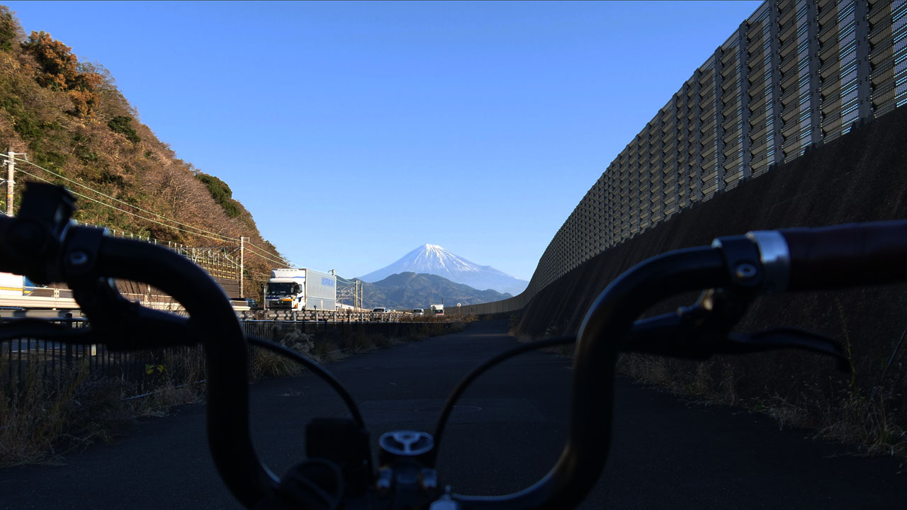
This mountain appears frequently along the route. It helps pass the time.
Lunch Strategy: Learn from Day 2
Learning from Day 2's hamburger struggles, I ate lunch early in Numazu. Lunch at Hakone? That's a tourist trap—expect crowds and lines everywhere.
Hakone Pass Details
- Distance: 13.2 km / 8.2 miles
- Elevation Gain: 736 m / 2,415 ft
- Average Grade: 5.5%
The climb from Mishima side is gentler than the Odawara side. For me—who climbed Shiretoko Pass on a folding bike without shifting gears—this felt like morning calisthenics.
But Then Google Maps Messed Up
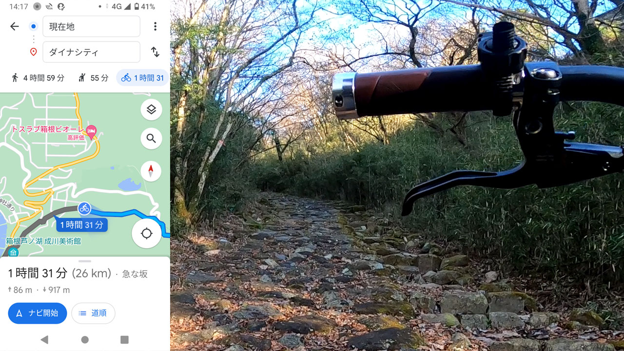
After encountering bicycle restrictions on the Nagoya-Shizuoka auto route, I used both walking and cycling routes in this area. The result? A detour onto Hakone's old road (which I had to carry my bike through). Wasted energy and time.
The correct Hakone hill climb route: National Route 1 or Prefectural Road 732—not the old road, not Google Maps' walking/cycling hybrid.
"Why does it suggest passing through a concrete gate next to 'Hakone Survival Game Field'?"
Winter mountain climbs are warm; descents are freezing. Mountain bike downhill = amazing. Road bike downhill = questionable.
The Final Stretch
I stopped at Hakone Pass roadside station for a snack, descended to Odawara, then joined Route 246 in Hiratsuka (Google Maps said it was shorter). This route had subtle ups and downs—slightly harder than sticking to Route 1 the whole way.
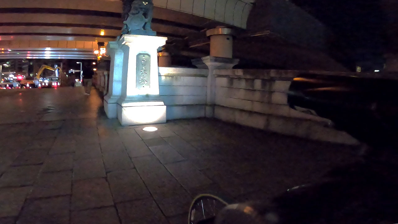
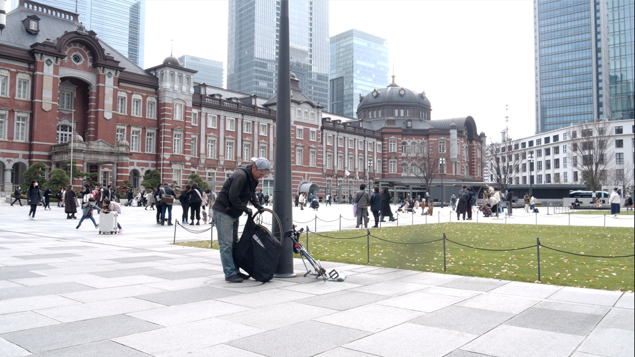
Arrival: Nihonbashi Bridge, Tokyo — 10:00 PM
172 km in 15 hours is abnormal. Average speed drops to 11.5 km/h. Google Maps data around Hakone was irregular. Actual distance might have been closer to 200 km?
Route: Shizuoka → Numazu → Hakone → Odawara → Hiratsuka → Ebina → Shibuya → Nihonbashi
Tokyo Budget Accommodation Tips
Tokyo budget hotels concentrate north of here—Ueno, Asakusa, San-no-maru. Upscale areas like Shinjuku and Shibuya mostly have capsule hotels for budget options. Personally, I can't do capsules.
Osaka-Tokyo Cycling Summary
📊 Trip Statistics
- Total Distance: 500–580 km (avg. ~540 km / 336 miles)
- Elevation Gain: 4,000–6,000 m
- Duration: 3 days, 2 nights
- Period: December 14-17, 2022
- Direction: Osaka → Tokyo (tailwind advantage)
💰 Cost Summary (3 days)
- Accommodation: ¥9,800 total
- Food: ~¥7,500 (¥2,500/day)
- Emergency train pass: ¥11,800
- Bike cost: ¥50,000 (one-time investment)
Key Takeaways
- Wind & weather are critical on one-way long rides. A wrong choice can ruin everything. Aim for tailwind or calm days—seriously.
- Bike shops and parallel train lines exist throughout the route, making emergency exits easy. But always carry a puncture kit and travel bag.
- The mental challenge of Day 2 (monotonous Nagoya-Shizuoka) is harder than physical climbs. Sawayaka hamburger steaks recover both heart and stomach.
- Iga Pass and Hakone Pass are the main climbing challenges. Avoidance routes exist but add significant distance.
Frequently Asked Questions
What is a 'Cannonball' cycling challenge?
A Cannonball is completing the Osaka-Tokyo route (or vice versa) in under 24 hours—named after historic automobile races. This guide covers a relaxed 3-day version covering ~500km, suitable for experienced cyclists seeking adventure without extreme time pressure.
Is this route beginner-friendly?
Not really. This is a serious long-distance ride requiring fitness, bike maintenance experience, and proper gear. The route includes significant climbs (Iga Pass, Hakone Pass) totaling 4000-6000m elevation gain over 3 days. Consider shorter training rides first.
What's the best time of year to attempt this?
Spring (April-May) or autumn (October-November). Avoid summer heat and winter cold—both extremes make 500+ km miserable. Wind direction matters too; Osaka→Tokyo generally gets tailwinds from the west.
How much does this trip cost?
Budget approximately ¥5,000/night for accommodation and ¥2,500/day for food. My total was under ¥10,000 for 3 nights of lodging plus meals. The main expense is food if you eat at restaurants regularly.