Hokkaido 2500km Cycling Loop: Complete Budget Guide (August 2022)
Defeated by an absurd heatwave at the end of a dry rainy season, I booked a flight to Hokkaido. This is B4C.
The ticket date was August 1, 2022. One-way only. Return date undecided—I figured I'd come back when I got bored or something catastrophic happened.
Contrary to most predictions, I didn't quit mid-journey. I completed the full 2500km (1,553 miles) Hokkaido loop without incident, enjoyed a vacation afterward, and spent just under a month on Japan's northern island.
This guide documents costs, duration, routes, and lessons learned for anyone planning to cycle around Hokkaido or embark on similar cycling adventures.
Basic Information: The "Huge Road"
A wise person once said:
"Hokkaido is a huge road."
This statement is true. Mainland Japan's sense of distance doesn't apply to this massive island.
Japan Cycling Loop Comparison
- Awaichi (Awaji Island): 150km / 93 miles
- Biwaichi (Lake Biwa): 250km / 155 miles
- Shikoku Loop: 1,000km / 621 miles
- Kyushu Loop: 1,500km / 932 miles
- Hokkaido Loop: 2,500km / 1,553 miles
Yes—one island equals the combined regional scale of Shikoku and Kyushu.
"The nearest convenience store is 30km away."
A casual remark from an innkeeper at Cape Sōya, Japan's northernmost point. That's the Osaka-Kobe distance. Evening onigiri runs are not guaranteed.
The "Real Hokkaido" North vs. Modern South
Hokkaido's vastness divides it into four regions: Central (Dō-ō), Eastern (Dō-tō), Southern (Dō-nan), and Northern (Dō-hoku). There is no "Western Hokkaido."
Hokkaido Regional Breakdown
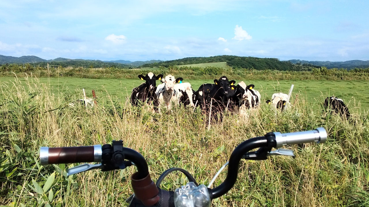
🏔️ Northern & Eastern Hokkaido = Rural
- Sparse population
- Wildlife encounters common (deer, horses, cows, foxes, bears)
- Long stretches without services
- Superb empty roads for cycling
🏙️ Central & Southern Hokkaido = Urban
- Sapporo and major cities located here
- Towns within 100km of each other
- More traffic, especially near Sapporo
- "Connected urban areas"
This distinction holds true by my "nearest convenience store/supermarket index." Northern Hokkaido is the real deal.
The Oloron Line (Route 108 from Teshio to Wakkanai) and Esanuka Line near Saru-fushi are must-ride super-highways for motorcyclists and cyclists—epic stretches of nothingness.
Eastern Hokkaido: Passes & Fog
The east features mountain passes and fog. Shiretoko Pass—the toughest challenge on the loop—sits between Abashiri and Rausu. The Nemuro, Kitatappu, and Atka areas are misty.
Southern & Central: More Civilized
The south and central regions aren't as wild. You can reach the next urban area within 100km, and you'll see houses and people along the way—what cyclists call "connected towns."
⚠️ Traffic Warning: As you approach Sapporo, traffic increases. The final clockwise stretch from Iwanai → Yorozu → Otaru is tunnel-heavy. Stay alert—wear a reflective vest!
I received a reflective vest as a gift from a Hokkaido 10-loop veteran helper and wore it religiously.
The tunnels around Yōichi are genuinely terrifying. Don't forget accident prevention measures or rear lights.
Elevation Gain
🗺️ Google Maps Navigation
7,000m / 22,966ft
(My measurement)🚴 Hokkaido Cycling Association
14,201m / 46,591ft
(Official figure)"What, that much?" Google Maps navigation elevation data isn't reliable.
The Main Challenge: Shiretoko Pass
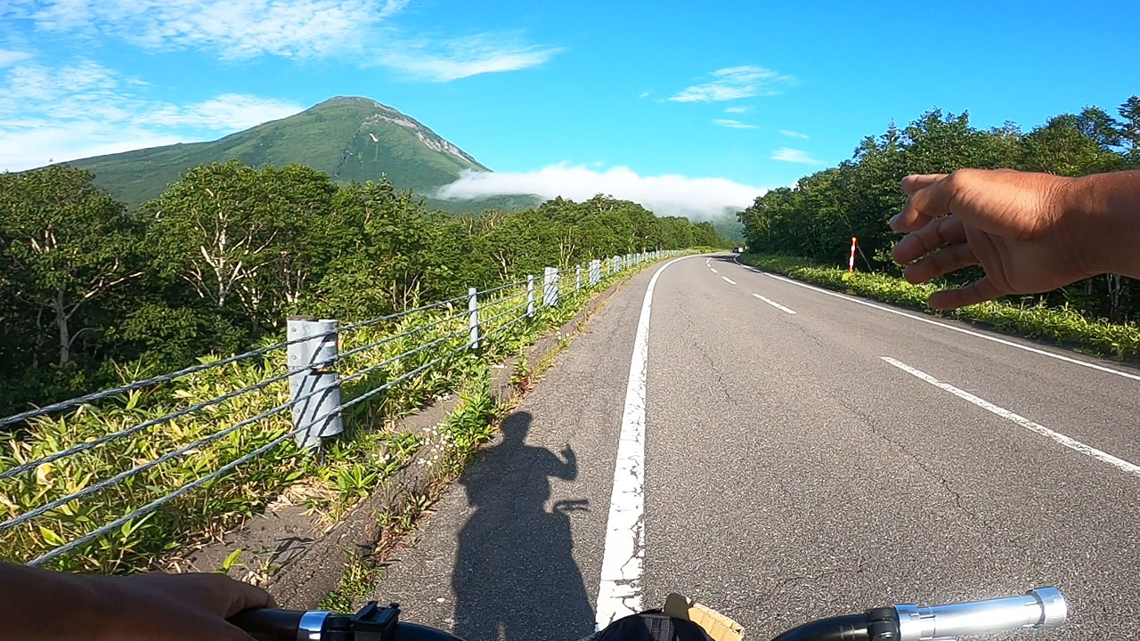
The peak is 741m / 2,431ft. The Utoro side has a dull but long climb; the Rausu side features switchbacks with steeper gradients.
I rode a single-speed Dahon folding bike—this pass was extremely difficult. Plus bears appear regularly and thick fog rolls in.
Bear Safety: Seeing a cub is the most dangerous moment—the mother is 100% nearby. Bears are overprotective parents.
Accidents make good YouTube content, but afterward everyone told me this bear advice.
Route Planning
The basic pattern for cycling around Hokkaido is: "Follow coastal roads relentlessly."
The route follows this principle—stick to the national highway closest to the sea.
Route Planning Tips
- Google Maps cycling routes work throughout Hokkaido (as of August 2022)
- Combine with walking navigation for ideal routes
- My Google Maps route matched the Cycling Association's recommended route almost exactly
- Google Maps elevation is unreliable, but distance is generally accurate
Intermediate Rider Options
I met a cyclist in Sapporo who said "I went to Okushiri Island"—a ferry trip from Esashi.
The inland route features Furano, Daisetsuzan National Park, and Lake Mashu—basically mountains. The Kushiro → Obihiro → Erimo detour is a fairly popular side trip.
Clockwise or Counter-Clockwise?
"Islands and lakes: clockwise. Peninsulas: counter-clockwise."
This cycling rule of thumb keeps water on your right when riding on the left side of roads.
Treating Hokkaido as a large island, following this theory means going clockwise. I rode from Sapporo to the Ishikari River mouth, then completed the full loop clockwise.
However, many counter-clockwise riders were on the road. No particular advantage either way—choose freely based on wind patterns or preference.
Road Conditions
Hokkaido's road surfaces are relatively rough—both urban and suburban areas are approximate.
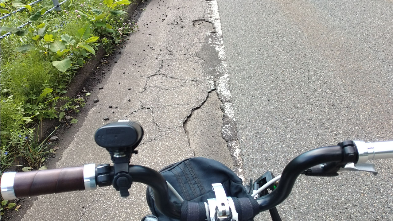
Especially the shoulders—about 70% look like this. Asphalt peels, with countless holes and cracks. This is largely due to cold weather and snow removal.
"Hokkaido roads aren't that good," several locals told me. Even I, an outsider, felt it.
Impact on Bikes
This condition is hard on road bike skinny tires or mini-velo small wheels. I experienced a dozen flats and several tire failures during this trip.
Ideal Bikes for Hokkaido
- Cross bikes ✓
- Hybrid/commuter bikes (mamachari) ✓
- Gravel bikes ✓
- Road bikes with thin tires ⚠️ (bring spares)
If using thin tires, bring spare tubes AND spare tires.
Tire Reality: I brought 3 spare tires, bought 2 more at Kushiro AEON Bike, used them all up completely, and finished by patching with Gorilla Tape.
14-inch folding bikes are not suitable for long-distance touring.
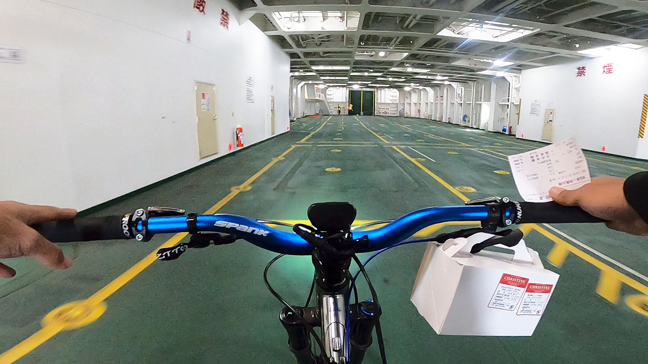
Getting to Hokkaido with a Bicycle
You cannot reach Hokkaido by road alone—use one of these public transport options.
I'm a travel lover who hates vehicles—a troublesome personality. I can ride a bike for 10 hours but can't sit on a bus or taxi for 10 minutes, seriously.
My Elimination Process
- Ferry: Maizuru → Otaru is 20 hours 55 minutes. Too long for me.
- Shinkansen: Shin-Osaka → Shinhakodate-Hokuto is 7 hours 30 minutes. Not easy either.
- No early-bird discounts on trains or ferries like airline tickets.
ANA Flight Bike Transport = Justice
Automatically, ANA's Mach 1 Boeing 787 was selected. My first flight bike transport in about a year since Beppu, Oita.
Flight Comparison
| Route | Time | Bike Fee | Total (approx.) |
|---|---|---|---|
| Itami → New Chitose (ANA) | 1h 50min | Included | ¥17,810 |
| Kansai → New Chitose (LCC) | 2h 10min | +¥3,900 | ~¥15,000 + train to KIX |
| Shin-Osaka → Shinhakodate (JR) | 7h 30min | Included | ¥32,790 |
| Maizuru → Otaru (Ferry) | 20h 55min | +¥3,300 | ¥14,400 |
I booked ANA flight 777 on August 1, 2022 (Itami → New Chitose) on July 11 using Super Value 21K. Price: ¥17,810.
Booking Tip: ANA's baggage regulations are slightly more lenient than JAL's (no long-side limit specified). Book 21 days in advance for best prices.
Why Not LCC?
Kansai Airport LCC flights charge extra for bikes (¥3,900). Add train fare to Kansai Terminal 2—"the end of the world"—and Peach's budget appeal fades.
Itami Airport is within cycling distance from my home. ANA and JAL include baggage fees in ticket price.
Ferry Bike Transport Benefits
🚢 No Restrictions!
- No size limits—full-suspension MTBs OK
- No weight limits
- E-bikes welcome (lithium batteries prohibited on planes)
- No disassembly required
- No packing needed
E-bike Note: Lithium batteries are completely blacklisted on passenger aircraft. Experienced e-bikers ship batteries separately via Yamato Transport, then assemble at destination. Ferries require none of this hassle.
Duration: How Many Days?
The basic Hokkaido loop is 2500km (1,553 miles) of flat coastal roads. Only Shiretoko Pass has extreme climbing. Next is Tomakomai → Shinhonbetsu's four ups and downs. Otherwise nearly flat.
The Math: 100km/Day
Standard Pace Calculation
- Total distance: 2,500km / 1,553 miles
- Daily target: 100km / 62 miles
- Duration: 25 days
This isn't difficult. A very realistic goal—assuming no typhoons, accidents, mechanical failures, or illness.
Hokkaido Cycling Association Tour: 24 days with support car, support riders, and group ride—quite leisurely pace.
My Extreme Schedule
I tightened it slightly: August 2-20, net 19 days. That's 130km/day (81 miles).
⚠️ Not Recommended for Most Riders
Achieving this on a non-gear-shifting 14-inch Dahon Dove Plus requires superhuman stamina, intelligence, rare adaptability, determination, and luck.
Ordinary people should not overestimate abilities. Know your limits and plan milder schedules. It's either the rider or the equipment that will speak up.
Cost Breakdown
Hokkaido loop costs depend on duration. Main expenses are food and accommodation.
I secured all accommodations in advance, planning for video editing and YouTube uploads. Solo obitori (no meals) reservations during Obon were tricky but I got nearly ideal spacing.
Tax Deduction: As a YouTuber creating content, travel and food costs are business expenses. I kept all receipts carefully.
Transportation Costs
- ANA Itami → New Chitose: ¥17,810
- ANA New Chitose → Itami: ¥16,610
- JR New Chitose ↔ Sapporo (round trip): ¥2,300
Total transportation: ¥36,720. Super Value 21K early-bird discount made flights very affordable. Home to Itami Airport by bike = ¥0.
Accommodation Costs
📊 Accommodation Summary (19 nights)
- Total: ¥97,645
- Average per night: ¥5,139
- Cheapest: ¥2,500 (Oikaruya - private room in rider house, no bath)
- Most expensive: ¥10,000 (Hotel Longchamp Sapporo - Saturday + summer vacation premium)
Average is roughly ¥5,000/night. On-site payment and online reservations are similar.
Budget Option: If you don't mind camping, use campgrounds and day-trip hot springs throughout Hokkaido for a very cheap loop. A good tent pays for itself quickly.
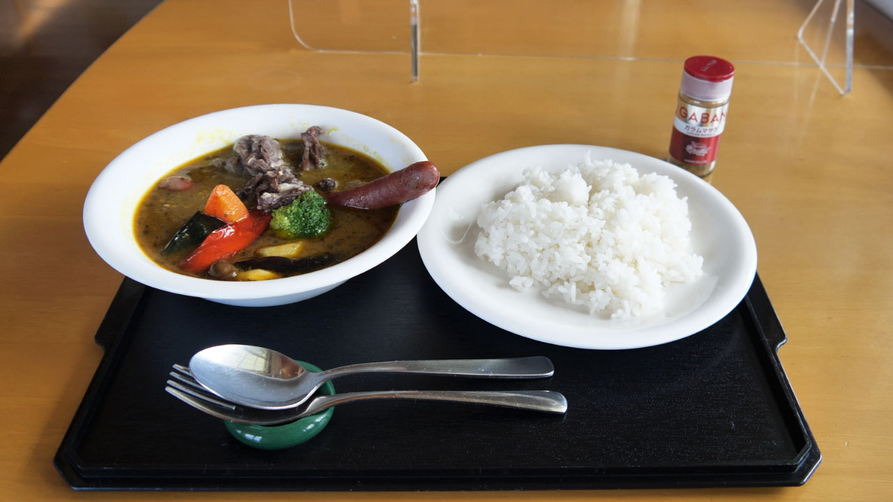
Food Costs
🍜 Daily Food Budget Breakdown
- Lunch: ~¥1,200
- Dinner: ~¥800 (supermarket)
- Soft serve ice cream: ~¥350
Total per day: ~¥2,500
This fits within ¥2,500/day.
Personal Lunch Top 3
- Tankaku Ōkoku: Beef sausage
- Conchiglie: Uni risotto with raw oysters
- Lucky Pierrot: Chinese chicken burger set
Essential Gear & Tips
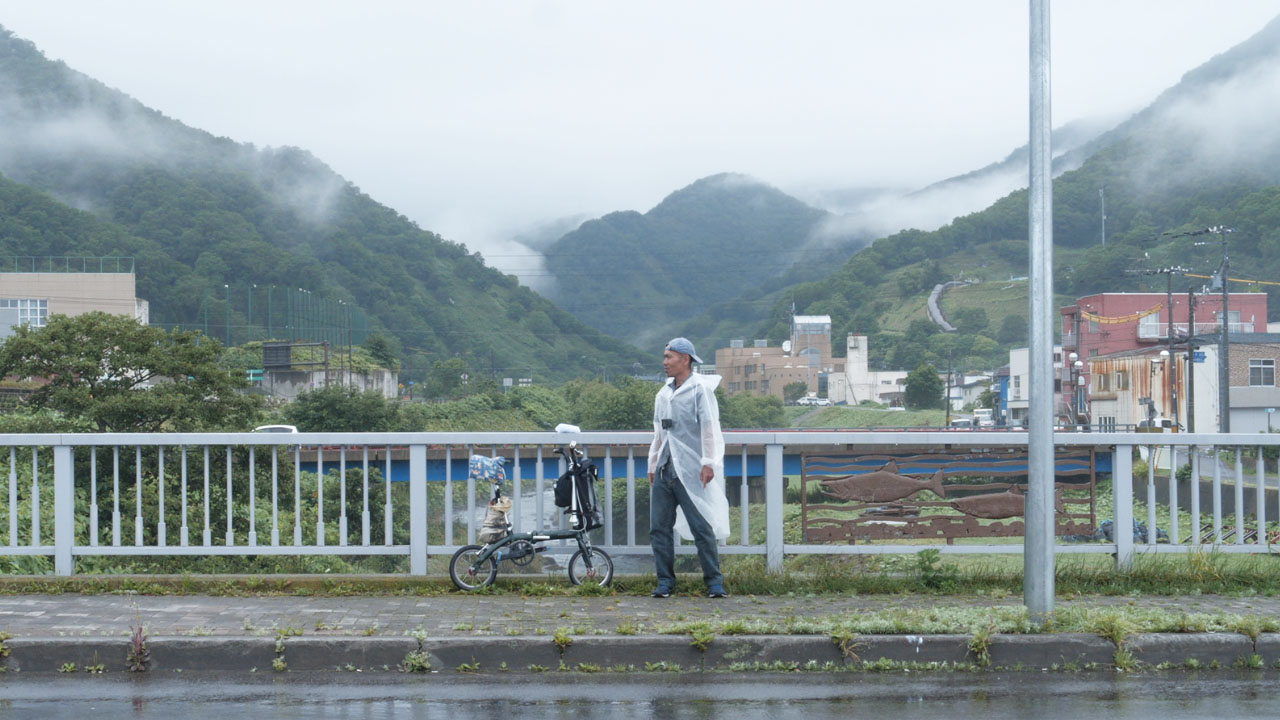
I temporarily lost my wallet in Numata (forgot it at a supermarket) and learned the importance of backups. Seriously, I nearly game-overed.
Lesson: With money, you can buy anything locally. But my Dahon 14-inch tires barely exist in stores. Minor-spec bikes for touring = not recommended.
Puncture Prevention
Punctures are cycling's fate. Road bike skinny clincher tires are basically puncture god summoning devices.
🚨 My Tire Disaster Timeline
- Brought: 2 used + 3 spare tires, 2 spare tubes
- Halfway through trip: All depleted
- Miraculously found 14-inch tire at Kushiro AEON Bike—bought more
- A few hundred km later: Bead failed
- Final solution: Gorilla Tape repairs to finish
This is extreme, but completing 2500km without flats or issues isn't realistic.
Mandatory Items
- Portable air pump ✓
- Puncture repair kit ✓
- Spare tubes (multiple) ✓
- Spare tires (at least 2-3) ✓
- Gloves, hand towels, wet wipes (for dirty hands) ✓
Motivation Killer: Dirty hands from outdoor repairs drastically lower motivation. This hits mentally.
Portable Tools
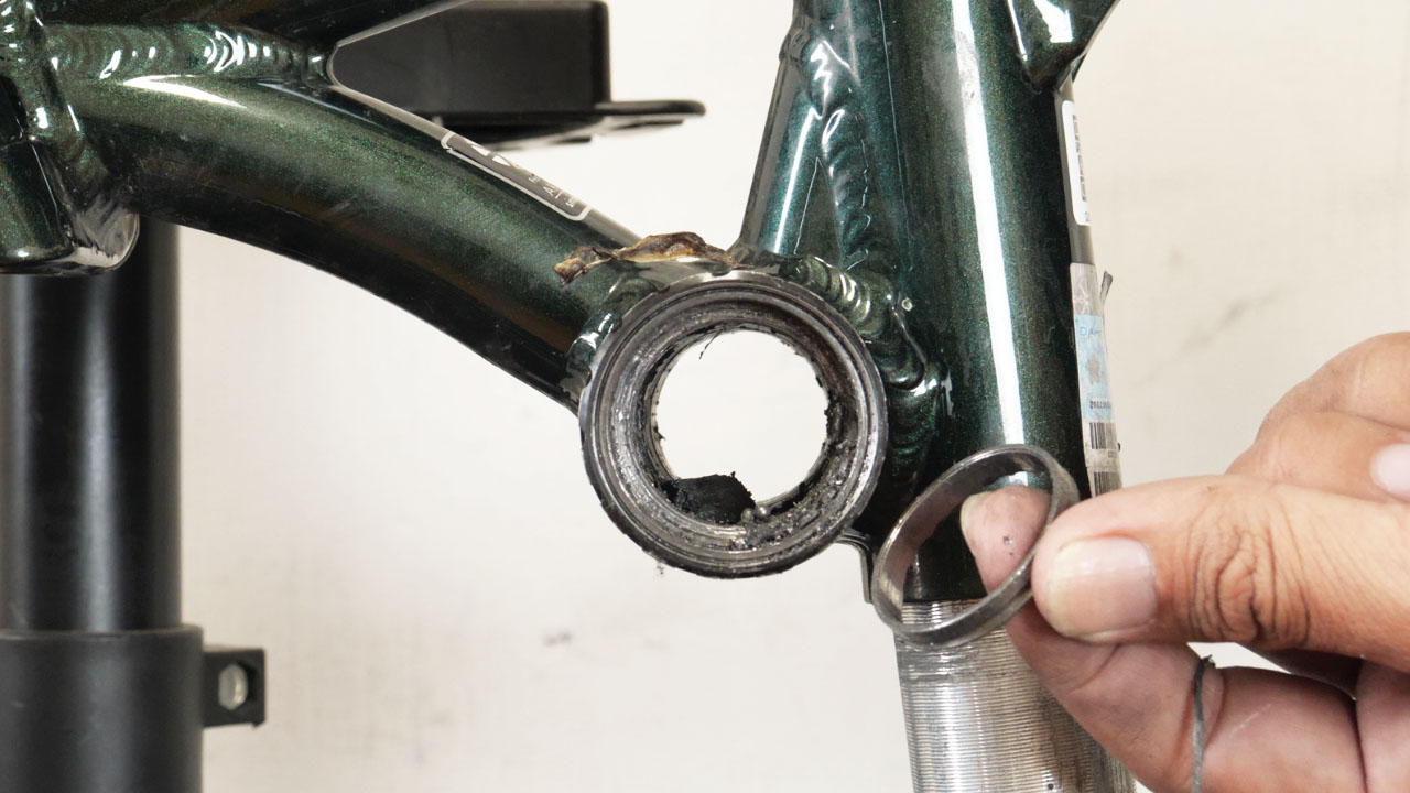
Punctures are just the beginning. Long trips bring unexpected issues—especially fragile folding bikes.
My Troubles (Black = Expected, Red = Unexpected)
- Slow punctures
- Piercing punctures
- Burst punctures
- Tire deformation
- Chain drops
- Bead tear
- Grip peeling
- Crank play
- BB cup ejection
- Spoke breakage
- Rear wheel freewheel failure
"Who could predict the rear freehub ratchet pawl spring breaking?!"
The "going-out trio"—portable pump, puncture kit, portable tools—is mandatory.
Bike Shop Reality in Hokkaido
Bicycle shops are niche businesses in rural Hokkaido. Asahi and AEON Bike only in cities; individual shops rare. Most are motorcycle shop side businesses.
If you need something unavailable locally, order online with Yamato delivery to business office, post office hold, or accommodation.
Hokkaido Cycling Loop Summary
📊 Trip Statistics
- Distance: 2,500km / 1,553 miles
- Elevation gain: ~14,000m / 46,000ft
- Duration: 19 nights, 20 days
- Period: August 2022
- Direction: Clockwise
💰 Cost Summary (20 days)
- Accommodation: ¥5,000 × 20 = ¥100,000
- Food: ¥2,500 × 20 = ¥50,000
- Flights: ~¥34,000
- Bear encounters: Multiple sightings, including cubs
- Typhoon impact: Direct hit during trip
- Night earthquake: Woke up to shaking
- Lost wallet: Forgotten at supermarket in Num
Frequently Asked Questions
How long does it take to cycle around Hokkaido?
The standard route is 2500km (1,553 miles). At 100km/day this takes about 25 days. The author completed it in 19 days at 130km/day on a single-speed folding bike—an extreme pace not recommended for most riders.
What's the best way to get to Hokkaido with a bicycle?
Flying is fastest (1h 50min from Osaka). ANA includes bike baggage in ticket price. Ferry takes 20+ hours but has no size/weight limits—ideal for e-bikes or large MTBs. Shinkansen costs ¥32,790 one-way.
How much does a Hokkaido cycling trip cost?
Budget approximately ¥5,000/day for accommodation and ¥2,500/day for food. Round-trip flights from Osaka: ~¥34,000 with advance booking. Total trip cost (excluding gear): roughly ¥180,000-200,000 for 20 days.
What are the road conditions like in Hokkaido?
Roads are rougher than mainland Japan due to winter snow removal. Shoulders often have cracks and potholes. Expect multiple flats—bring spare tubes, tires, pump, and repair kit. Gravel bikes or hybrid bikes recommended over road bikes.
What's the hardest part of the Hokkaido loop?
Shiretoko Pass (741m / 2,431ft elevation) between Utoro and Rausu is the main challenge. Also watch for fog in Nemuro area, wildlife encounters (bears!), and tunnel-heavy sections near Otaru.
Clockwise or counter-clockwise?
The cycling rule of thumb: 'Islands and lakes clockwise, peninsulas counter-clockwise' keeps water on your right. Hokkaido is an island, so go clockwise. However, both directions work—choose based on wind patterns or personal preference.